Earthquake HALMAHERA, INDONESIA
Tue, 19 Nov 2013 13:32:55 GMT
Time12 years ago
Location
2.7100, 128.4300
Depth
66.0 KM
Event Summary
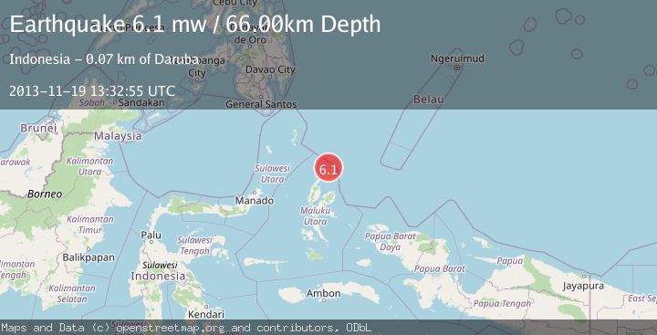
A 6.1 magnitude earthquake struck on HALMAHERA, INDONESIA, at Tue, 19 Nov 2013 13:32:55 GMT. Depth: 66km. Reviewed by EMSC seismologists, this strong quake occurred at a magnitude type of mw.
Magnitude
6.1
mw
Source
EMSC
Intensity
-
Agency Reports
1 Sources| Source | Magnitude | Depth | Time |
|---|---|---|---|
| EMSCPrimary | 6.1 | 66 km | 12 years ago |
Earthquake Details
AutomaticEvent IDemsc_EMSC_20131119_0000043
Tsunami PotentialNo
Magnitude Typemw
Nearest Places
- Tanjung Padangi13.3 km
- Padangi14.6 km
- Tanjung Berri Berri15.3 km
- Bere Bere16.0 km
- Teluk Sopi16.3 km
Comments
Join the discussion about this event.
Latest Earthquakes
2.1Mag
Antofagasta, Chile
Time1 minute ago
Depth82.15 km
SourceVYT (Automatic)
2.1Mag
Southern Alaska
Time3 minutes ago
Depth64.21 km
SourceVYT (Automatic)
2.5Mag
Central Alaska
Time9 minutes ago
Depth312.99 km
SourceVYT (Automatic)
3.6Mag
Banda Sea
Time15 minutes ago
Depth0.00 km
SourceVYT (Automatic)
1.9Mag
western Texas
Time20 minutes ago
Depth0.24 km
SourceVYT (Automatic)
Nearby Earthquakes
4.0Mag
HALMAHERA, INDONESIA
Time5 years ago
Depth21.00 km
SourceDJA (Automatic)
5.0Mag
HALMAHERA, INDONESIA
Time19 years ago
Depth49.00 km
SourceEMSC (Automatic)
5.5Mag
HALMAHERA, INDONESIA
Time13 years ago
Depth215.00 km
SourceEMSC (Automatic)
3.0Mag
HALMAHERA, INDONESIA
Time10 months ago
Depth10.00 km
SourceBMKG (Automatic)
3.0Mag
HALMAHERA, INDONESIA
Time5 years ago
Depth207.00 km
SourceDJA (Automatic)