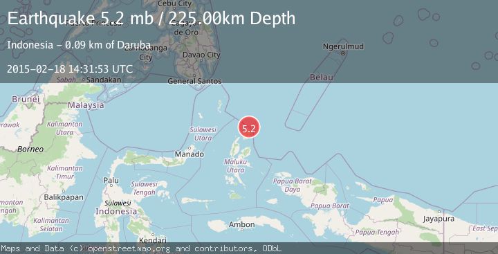
Earthquake HALMAHERA, INDONESIA
Wed, 18 Feb 2015 14:31:53 GMT
Time11 years ago
Location
2.8200, 128.6500
Depth
225.0 KM
Event Summary
A 5.2 magnitude earthquake struck on HALMAHERA, INDONESIA, at Wed, 18 Feb 2015 14:31:53 GMT. Depth: 225km. Reviewed by EMSC seismologists, this moderate quake occurred at a magnitude type of mb.
Magnitude
5.2
mb
Source
EMSC
Intensity
-
Agency Reports
1 Sources| Source | Magnitude | Depth | Time |
|---|---|---|---|
| EMSCPrimary | 5.2 | 225 km | 11 years ago |
Earthquake Details
AutomaticEvent IDemsc_EMSC_20150218_0000038
Tsunami PotentialNo
Magnitude Typemb
Nearest Places
- Tanjung Sopi21.6 km
- Kakaibabao23.6 km
- Papuamalolu23.7 km
- Tanjung Modiu25.7 km
- Desa Loleo26.7 km
Comments
Join the discussion about this event.
Latest Earthquakes
1.1Mag
Southern Alaska
Time1 minute ago
Depth37.11 km
SourceVYT (Automatic)
1.1Mag
Washington
Time6 minutes ago
Depth9.64 km
SourceVYT (Automatic)
1.9Mag
32 km NW of Toyah, Texas
Time8 minutes ago
Depth4.09 km
SourceUSGS (Automatic)
1.7Mag
western Texas
Time11 minutes ago
Depth3.42 km
SourceVYT (Automatic)
3.8Mag
Seram, Indonesia
Time13 minutes ago
Depth0.00 km
SourceVYT (Automatic)
Nearby Earthquakes
4.9Mag
HALMAHERA, INDONESIA
Time1 month ago
Depth231.20 km
SourceEMSC (Automatic)
5.1Mag
HALMAHERA, INDONESIA
Time3 years ago
Depth228.00 km
SourceEMSC (Automatic)
5.0Mag
HALMAHERA, INDONESIA
Time6 years ago
Depth230.00 km
SourceEMSC (Automatic)
5.1Mag
HALMAHERA, INDONESIA
Time14 years ago
Depth217.00 km
SourceEMSC (Automatic)
5.2Mag
HALMAHERA, INDONESIA
Time4 years ago
Depth230.00 km
SourceEMSC (Automatic)