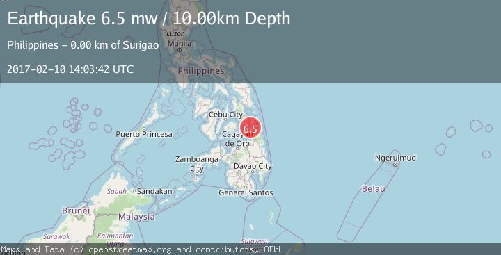
Earthquake MINDANAO, PHILIPPINES
Fri, 10 Feb 2017 14:03:42 GMT
Time9 years ago
Location
9.8300, 125.5000
Depth
10.0 KM
Event Summary
A 6.5 magnitude earthquake struck on MINDANAO, PHILIPPINES, at Fri, 10 Feb 2017 14:03:42 GMT. Depth: 10km. Reviewed by EMSC seismologists, this strong quake occurred at a magnitude type of mw.
Magnitude
6.5
mw
Source
EMSC
Intensity
-
Agency Reports
1 Sources| Source | Magnitude | Depth | Time |
|---|---|---|---|
| EMSCPrimary | 6.5 | 10 km | 9 years ago |
Earthquake Details
AutomaticEvent IDemsc_EMSC_20170210_0000127
Tsunami PotentialNo
Magnitude Typemw
Nearest Places
- Basol Island2.4 km
- Surigao3.3 km
- Bingad Island3.8 km
- Beelzebub Reef4.1 km
- Onate Rock4.2 km
Comments
Join the discussion about this event.
Latest Earthquakes
2.7Mag
Western Australia
Time2 minutes ago
Depth485.47 km
SourceVYT (Automatic)
3.2Mag
Sumba region, Indonesia
Time3 minutes ago
Depth127.93 km
SourceVYT (Automatic)
2.7Mag
Minahasa, Sulawesi, Indonesia
Time3 minutes ago
Depth201.29 km
SourceVYT (Automatic)
3.8Mag
Kenai Peninsula, Alaska
Time9 minutes ago
Depth49.93 km
SourceVYT (Automatic)
5.7Mag
HINDU KUSH REGION, AFGHANISTAN
Time13 minutes ago
Depth72.80 km
SourceGFZ (Automatic)
Nearby Earthquakes
5.0Mag
MINDANAO, PHILIPPINES
Time9 years ago
Depth40.00 km
SourceEMSC (Automatic)
5.7Mag
MINDANAO, PHILIPPINES
Time8 years ago
Depth30.00 km
SourceEMSC (Automatic)
3.0Mag
MINDANAO, PHILIPPINES
Time10 months ago
Depth14.00 km
SourcePIVS (Automatic)
3.0Mag
MINDANAO, PHILIPPINES
Time5 years ago
Depth17.00 km
SourcePIVS (Automatic)
5.2Mag
MINDANAO, PHILIPPINES
Time9 years ago
Depth10.00 km
SourceEMSC (Automatic)