Earthquake NEAR N COAST OF PAPUA, INDONESIA
Sun, 12 Feb 2017 09:32:30 GMT
Time9 years ago
Location
-2.2000, 139.1900
Depth
40.0 KM
Event Summary
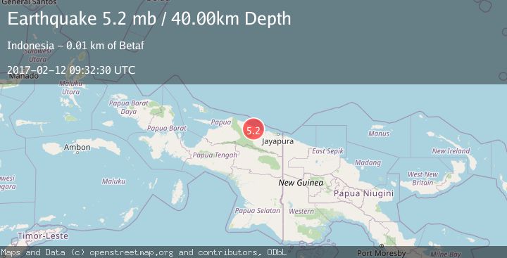
A 5.2 magnitude earthquake struck on NEAR N COAST OF PAPUA, INDONESIA, at Sun, 12 Feb 2017 09:32:30 GMT. Depth: 40km. Reviewed by EMSC seismologists, this moderate quake occurred at a magnitude type of mb.
Magnitude
5.2
mb
Source
EMSC
Intensity
-
Agency Reports
1 Sources| Source | Magnitude | Depth | Time |
|---|---|---|---|
| EMSCPrimary | 5.2 | 40 km | 9 years ago |
Earthquake Details
AutomaticEvent IDemsc_EMSC_20170212_0000037
Tsunami PotentialNo
Magnitude Typemb
Nearest Places
- Gunung Temongsir2.6 km
- Gunung Siduas7.3 km
- Kampung Yamben8.0 km
- Sungai Kwaritor11.4 km
- Betaf11.8 km
Comments
Join the discussion about this event.
Latest Earthquakes
3.4Mag
San Juan, Argentina
Time7 minutes ago
Depth10.00 km
SourceVYT (Automatic)
3.0Mag
Potosi, Bolivia
Time9 minutes ago
Depth269.04 km
SourceVYT (Automatic)
2.4Mag
Central Alaska
Time11 minutes ago
Depth0.24 km
SourceVYT (Automatic)
3.7Mag
Seram, Indonesia
Time11 minutes ago
Depth0.00 km
SourceVYT (Automatic)
3.9Mag
North of Halmahera, Indonesia
Time12 minutes ago
Depth14.71 km
SourceBMKG
Nearby Earthquakes
5.8Mag
NEAR N COAST OF PAPUA, INDONESIA
Time19 years ago
Depth10.00 km
SourceEMSC (Automatic)
3.8Mag
Near North Coast of West Papua
Time1 week ago
Depth11.63 km
SourceBMKG (Automatic)
3.2Mag
Near North Coast of West Papua
Time0 months ago
Depth25.99 km
SourceBMKG (Automatic)
6.4Mag
NEAR N COAST OF PAPUA, INDONESIA
Time18 years ago
Depth47.00 km
SourceEMSC (Automatic)
5.0Mag
NEAR N COAST OF PAPUA, INDONESIA
Time4 months ago
Depth41.00 km
SourceEMSC (Automatic)