Earthquake KEPULAUAN BABAR, INDONESIA
Sun, 26 Mar 2017 19:14:37 GMT
Time8 years ago
Location
-7.1600, 129.8900
Depth
142.0 KM
Event Summary
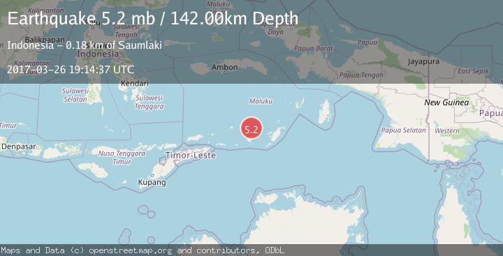
A 5.2 magnitude earthquake struck on KEPULAUAN BABAR, INDONESIA, at Sun, 26 Mar 2017 19:14:37 GMT. Depth: 142km. Reviewed by EMSC seismologists, this moderate quake occurred at a magnitude type of mb.
Magnitude
5.2
mb
Source
EMSC
Intensity
-
Agency Reports
1 Sources| Source | Magnitude | Depth | Time |
|---|---|---|---|
| EMSCPrimary | 5.2 | 142 km | 8 years ago |
Earthquake Details
AutomaticEvent IDemsc_EMSC_20170326_0000086
Tsunami PotentialNo
Magnitude Typemb
Nearest Places
- Wakarlawen47.6 km
- Desa Lewah48.6 km
- Lewa48.8 km
- Desa Sinairusi49.0 km
- Desa Hertuti49.7 km
Comments
Join the discussion about this event.
Latest Earthquakes
2.6Mag
western Texas
Time2 minutes ago
Depth12.70 km
SourceVYT (Automatic)
2.0Mag
Sumbawa Region, Indonesia
Time3 minutes ago
Depth21.49 km
SourceBMKG
1.0Mag
Southern Alaska
Time4 minutes ago
Depth1.34 km
SourceVYT (Automatic)
1.7Mag
Dead Sea region
Time5 minutes ago
Depth0.00 km
SourceVYT (Automatic)
2.8Mag
ICELAND
Time6 minutes ago
Depth0.30 km
SourceIMO (Automatic)
Nearby Earthquakes
5.2Mag
KEPULAUAN BABAR, INDONESIA
Time11 years ago
Depth132.00 km
SourceEMSC (Automatic)
5.3Mag
KEPULAUAN BABAR, INDONESIA
Time21 years ago
Depth17.00 km
SourceNEIC (Automatic)
5.5Mag
KEPULAUAN BABAR, INDONESIA
Time17 years ago
Depth141.00 km
SourceEMSC (Automatic)
5.0Mag
KEPULAUAN BABAR, INDONESIA
Time11 years ago
Depth140.00 km
SourceEMSC (Automatic)
4.5Mag
Banda Sea
Time1 week ago
Depth153.08 km
SourceBMKG (Automatic)