Earthquake KEPULAUAN TALAUD, INDONESIA
Mon, 12 Jun 2017 04:30:37 GMT
Time8 years ago
Location
3.7400, 126.7600
Depth
60.0 KM
Event Summary
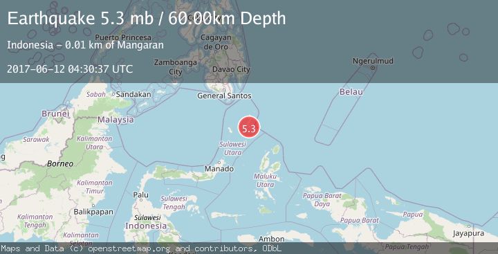
A 5.3 magnitude earthquake struck on KEPULAUAN TALAUD, INDONESIA, at Mon, 12 Jun 2017 04:30:37 GMT. Depth: 60km. Reviewed by EMSC seismologists, this moderate quake occurred at a magnitude type of mb.
Magnitude
5.3
mb
Source
EMSC
Intensity
-
Agency Reports
1 Sources| Source | Magnitude | Depth | Time |
|---|---|---|---|
| EMSCPrimary | 5.3 | 60 km | 8 years ago |
Earthquake Details
AutomaticEvent IDemsc_EMSC_20170612_0000014
Tsunami PotentialNo
Magnitude Typemb
Nearest Places
- Pangeran2.9 km
- Tanjung Panii3.1 km
- Desa Pannulan4.2 km
- Desa Peret4.2 km
- Desa Pangeran4.5 km
Comments
Join the discussion about this event.
Latest Earthquakes
2.0Mag
Southern Alaska
Time6 minutes ago
Depth26.61 km
SourceVYT (Automatic)
2.8Mag
Central Alaska
Time10 minutes ago
Depth292.36 km
SourceVYT (Automatic)
1.0Mag
12 km ESE of Anza, CA
Time15 minutes ago
Depth18.49 km
SourceUSGS (Automatic)
3.2Mag
Molucca Sea
Time16 minutes ago
Depth0.12 km
SourceVYT (Automatic)
1.0Mag
33 km SE of Minto, Alaska
Time18 minutes ago
Depth8.60 km
SourceUSGS (Automatic)
Nearby Earthquakes
5.1Mag
KEPULAUAN TALAUD, INDONESIA
Time16 years ago
Depth48.00 km
SourceEMSC (Automatic)
4.0Mag
KEPULAUAN TALAUD, INDONESIA
Time4 years ago
Depth41.00 km
SourceDJA (Automatic)
5.0Mag
KEPULAUAN TALAUD, INDONESIA
Time1 year ago
Depth54.00 km
SourceEMSC (Automatic)
3.9Mag
KEPULAUAN TALAUD, INDONESIA
Time1 month ago
Depth38.00 km
SourceBMKG (Automatic)
6.3Mag
KEPULAUAN TALAUD, INDONESIA
Time16 years ago
Depth52.00 km
SourceEMSC (Automatic)