Earthquake HALMAHERA, INDONESIA
Thu, 09 Nov 2017 03:11:02 GMT
Time8 years ago
Location
1.8700, 127.1500
Depth
110.0 KM
Event Summary
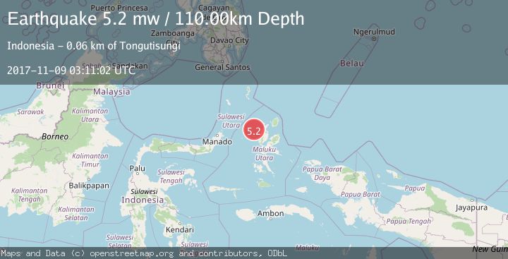
A 5.2 magnitude earthquake struck on HALMAHERA, INDONESIA, at Thu, 09 Nov 2017 03:11:02 GMT. Depth: 110km. Reviewed by EMSC seismologists, this moderate quake occurred at a magnitude type of mw.
Magnitude
5.2
mw
Source
EMSC
Intensity
-
Agency Reports
1 Sources| Source | Magnitude | Depth | Time |
|---|---|---|---|
| EMSCPrimary | 5.2 | 110 km | 8 years ago |
Earthquake Details
AutomaticEvent IDemsc_EMSC_20171109_0000007
Tsunami PotentialNo
Magnitude Typemw
Nearest Places
- Nyi40.0 km
- Nusa Sidanga43.7 km
- Nusa Nyaolaka44.2 km
- Nusa Sosota44.4 km
- Pulau Tutu44.5 km
Comments
Join the discussion about this event.
Latest Earthquakes
3.6Mag
Offshore southern Greece
Time1 hour ago
Depth200.20 km
SourceVYT (Automatic)
1.9Mag
Tarapaca, Chile
Time1 hour ago
Depth109.38 km
SourceVYT (Automatic)
1.0Mag
2 km W of Anderson Springs, CA
Time1 hour ago
Depth2.07 km
SourceUSGS (Automatic)
2.5Mag
Java, Indonesia
Time1 hour ago
Depth73.53 km
SourceBMKG
1.9Mag
Tarapaca, Chile
Time1 hour ago
Depth7.93 km
SourceVYT (Automatic)
Nearby Earthquakes
3.0Mag
HALMAHERA, INDONESIA
Time3 years ago
Depth102.00 km
SourceDJA (Automatic)
3.0Mag
HALMAHERA, INDONESIA
Time3 years ago
Depth96.00 km
SourceDJA (Automatic)
3.0Mag
HALMAHERA, INDONESIA
Time4 years ago
Depth29.00 km
SourceDJA (Automatic)
5.5Mag
HALMAHERA, INDONESIA
Time3 years ago
Depth60.00 km
SourceEMSC (Automatic)
3.1Mag
Halmahera, Indonesia
Time1 week ago
Depth30.42 km
SourceBMKG (Automatic)