Earthquake KEPULAUAN BARAT DAYA, INDONESIA
Sat, 17 Feb 2018 01:55:41 GMT
Time8 years ago
Location
-7.6600, 128.1300
Depth
130.0 KM
Event Summary
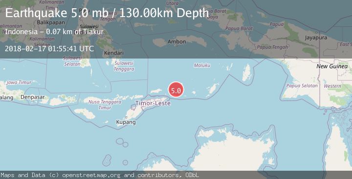
A 5.0 magnitude earthquake struck on KEPULAUAN BARAT DAYA, INDONESIA, at Sat, 17 Feb 2018 01:55:41 GMT. Depth: 130km. Reviewed by EMSC seismologists, this moderate quake occurred at a magnitude type of mb.
Magnitude
5.0
mb
Source
EMSC
Intensity
-
Agency Reports
1 Sources| Source | Magnitude | Depth | Time |
|---|---|---|---|
| EMSCPrimary | 5.0 | 130 km | 8 years ago |
Earthquake Details
AutomaticEvent IDemsc_EMSC_20180217_0000008
Tsunami PotentialNo
Magnitude Typemb
Nearest Places
- Kepulauan Barat Daya30.6 km
- Pantai Kiera52.8 km
- Tanjung Tiokioka52.9 km
- Tanjung Wawilasun54.5 km
- Pulau Juha55.1 km
Comments
Join the discussion about this event.
Latest Earthquakes
1.7Mag
western Texas
Time3 minutes ago
Depth3.42 km
SourceVYT (Automatic)
3.5Mag
Seram, Indonesia
Time5 minutes ago
Depth0.00 km
SourceVYT (Automatic)
1.6Mag
54 km WNW of Toyah, Texas
Time11 minutes ago
Depth0.00 km
SourceUSGS (Automatic)
2.2Mag
West Papua Region, Indonesia
Time12 minutes ago
Depth26.69 km
SourceBMKG
1.2Mag
WESTERN TURKEY
Time13 minutes ago
Depth7.00 km
SourceAFAD (Automatic)
Nearby Earthquakes
4.7Mag
Banda Sea
Time1 day ago
Depth153.69 km
SourceVYT (Automatic)
5.0Mag
KEPULAUAN BARAT DAYA, INDONESIA
Time8 years ago
Depth119.00 km
SourceEMSC (Automatic)
5.6Mag
KEPULAUAN BARAT DAYA, INDONESIA
Time9 years ago
Depth168.00 km
SourceEMSC (Automatic)
5.0Mag
KEPULAUAN BARAT DAYA, INDONESIA
Time1 year ago
Depth148.00 km
SourceEMSC (Automatic)
5.5Mag
KEPULAUAN BARAT DAYA, INDONESIA
Time12 years ago
Depth128.00 km
SourceEMSC (Automatic)