Earthquake BANDA SEA
Sun, 18 Feb 2018 04:47:20 GMT
Time8 years ago
Location
-4.9600, 130.5100
Depth
111.0 KM
Event Summary
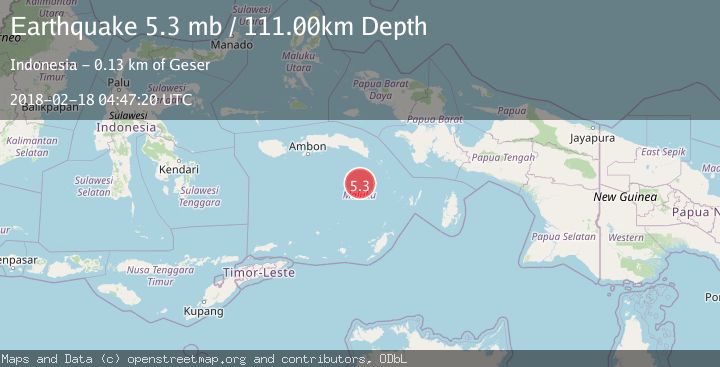
A 5.3 magnitude earthquake struck on BANDA SEA, at Sun, 18 Feb 2018 04:47:20 GMT. Depth: 111km. Reviewed by EMSC seismologists, this moderate quake occurred at a magnitude type of mb.
Magnitude
5.3
mb
Source
EMSC
Intensity
-
Agency Reports
1 Sources| Source | Magnitude | Depth | Time |
|---|---|---|---|
| EMSCPrimary | 5.3 | 111 km | 8 years ago |
Earthquake Details
AutomaticEvent IDemsc_EMSC_20180218_0000023
Tsunami PotentialNo
Magnitude Typemb
Nearest Places
- Banda Trench54.5 km
- Karang Hatta61.4 km
- Tanjung Buton64.7 km
- Tanjung Pulu66.1 km
- Desa Pulau Hatta66.3 km
Comments
Join the discussion about this event.
Latest Earthquakes
2.9Mag
Flores region, Indonesia
Time13 hours ago
Depth20.02 km
SourceVYT (Automatic)
1.7Mag
Southeastern Alaska
Time13 hours ago
Depth26.25 km
SourceVYT (Automatic)
5.7Mag
Minahasa, Sulawesi, Indonesia
Time13 hours ago
Depth31.98 km
SourceVYT (Automatic)
1.4Mag
Southern Alaska
Time13 hours ago
Depth24.41 km
SourceVYT (Automatic)
1.9Mag
Southeastern Alaska
Time13 hours ago
Depth0.00 km
SourceVYT (Automatic)
Nearby Earthquakes
3.3Mag
BANDA SEA
Time1 month ago
Depth7.00 km
SourceBMKG (Automatic)
5.4Mag
BANDA SEA
Time4 years ago
Depth97.00 km
SourceEMSC (Automatic)
4.0Mag
BANDA SEA
Time4 years ago
Depth183.00 km
SourceDJA (Automatic)
4.0Mag
BANDA SEA
Time3 years ago
Depth10.00 km
SourceDJA (Automatic)
4.0Mag
BANDA SEA
Time2 years ago
Depth136.00 km
SourceDJA (Automatic)