Earthquake SUMBA REGION, INDONESIA
Wed, 03 Oct 2018 12:38:04 GMT
Time7 years ago
Location
-10.4200, 120.1700
Depth
10.0 KM
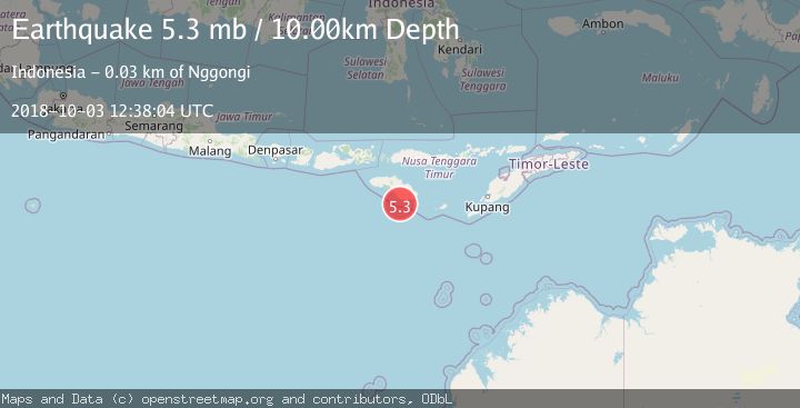
Event Summary
A 5.3 magnitude earthquake struck on SUMBA REGION, INDONESIA, at Wed, 03 Oct 2018 12:38:04 GMT. Depth: 10km. Reviewed by EMSC seismologists, this moderate quake occurred at a magnitude type of mb.
Magnitude
5.3
mb
Source
EMSC
Intensity
-
Agency Reports
1 Sources| Source | Magnitude | Depth | Time |
|---|---|---|---|
| EMSCPrimary | 5.3 | 10 km | 7 years ago |
Earthquake Details
AutomaticEvent IDemsc_EMSC_20181003_0000056
Tsunami PotentialNo
Magnitude Typemb
Nearest Places
- Pulau Mangudu11.5 km
- Desa Praisalura11.8 km
- Pulau Salura12.0 km
- Pulau Koatak15.2 km
- Tanjung Kahangaai19.4 km
Comments
Join the discussion about this event.
Latest Earthquakes
1.8Mag
Central Alaska
Time7 hours ago
Depth103.03 km
SourceVYT (Automatic)
1.3Mag
Washington
Time7 hours ago
Depth0.00 km
SourceVYT (Automatic)
1.6Mag
Kenai Peninsula, Alaska
Time7 hours ago
Depth21.36 km
SourceVYT (Automatic)
2.4Mag
South of Java, Indonesia
Time7 hours ago
Depth10.34 km
SourceBMKG
3.1Mag
Near North Coast of West Papua
Time7 hours ago
Depth46.31 km
SourceBMKG
Nearby Earthquakes
2.7Mag
Sumba Region, Indonesia
Time3 weeks ago
Depth14.72 km
SourceBMKG (Automatic)
4.0Mag
SUMBA REGION, INDONESIA
Time6 years ago
Depth14.00 km
SourceDJA (Automatic)
5.0Mag
SUMBA REGION, INDONESIA
Time7 years ago
Depth10.00 km
SourceEMSC (Automatic)
6.0Mag
SUMBA REGION, INDONESIA
Time7 years ago
Depth10.00 km
SourceEMSC (Automatic)
3.0Mag
SUMBA REGION, INDONESIA
Time1 year ago
Depth15.00 km
SourceBMKG (Automatic)