Earthquake SOUTH OF KERMADEC ISLANDS
Sat, 06 Jul 2019 17:52:19 GMT
Time6 years ago
Location
-32.8700, -178.1000
Depth
10.0 KM
Event Summary
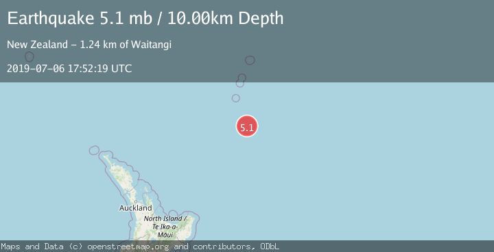
A 5.1 magnitude earthquake struck on SOUTH OF KERMADEC ISLANDS, at Sat, 06 Jul 2019 17:52:19 GMT. Depth: 10km. Reviewed by EMSC seismologists, this moderate quake occurred at a magnitude type of mb.
Magnitude
5.1
mb
Source
EMSC
Intensity
-
Agency Reports
1 Sources| Source | Magnitude | Depth | Time |
|---|---|---|---|
| EMSCPrimary | 5.1 | 10 km | 6 years ago |
Earthquake Details
AutomaticEvent IDemsc_EMSC_20190706_0000590
Tsunami PotentialNo
Magnitude Typemb
Nearest Places
- 106.3 km
- 122.5 km
- 146.2 km
- 149.4 km
- 156.4 km
Comments
Join the discussion about this event.
Latest Earthquakes
3.9Mag
eastern New Guinea region, Papua New Guinea
Time5 minutes ago
Depth58.47 km
SourceVYT (Automatic)
0.8Mag
15 km NE of Little Lake, CA
Time15 minutes ago
Depth1.26 km
SourceUSGS (Automatic)
1.9Mag
STRAIT OF GIBRALTAR
Time16 minutes ago
Depth0.00 km
SourceIGN (Automatic)
1.3Mag
Southern Alaska
Time16 minutes ago
Depth31.98 km
SourceVYT (Automatic)
2.7Mag
GREECE
Time21 minutes ago
Depth14.30 km
SourceNOA (Automatic)
Nearby Earthquakes
5.0Mag
SOUTH OF KERMADEC ISLANDS
Time10 years ago
Depth10.00 km
SourceEMSC (Automatic)
5.3Mag
SOUTH OF KERMADEC ISLANDS
Time7 years ago
Depth2.00 km
SourceEMSC (Automatic)
5.3Mag
SOUTH OF KERMADEC ISLANDS
Time6 years ago
Depth10.00 km
SourceEMSC (Automatic)
5.1Mag
SOUTH OF KERMADEC ISLANDS
Time1 year ago
Depth10.00 km
SourceEMSC (Automatic)
5.3Mag
SOUTH OF KERMADEC ISLANDS
Time18 years ago
Depth10.00 km
SourceEMSC (Automatic)