Earthquake SIMEULUE, INDONESIA
Tue, 07 Jan 2020 06:05:20 GMT
Time6 years ago
Location
2.4500, 96.4300
Depth
20.0 KM
Event Summary
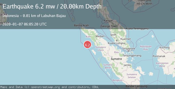
A 6.2 magnitude earthquake struck on SIMEULUE, INDONESIA, at Tue, 07 Jan 2020 06:05:20 GMT. Depth: 20km. Reviewed by EMSC seismologists, this strong quake occurred at a magnitude type of mw.
Magnitude
6.2
mw
Source
EMSC
Intensity
-
Agency Reports
1 Sources| Source | Magnitude | Depth | Time |
|---|---|---|---|
| EMSCPrimary | 6.2 | 20 km | 6 years ago |
Earthquake Details
AutomaticEvent IDemsc_EMSC_20200107_0000028
Tsunami PotentialNo
Magnitude Typemw
Nearest Places
- Dolok Pucuk Anau0.5 km
- Gampong Ana Ao0.7 km
- Gampong Kota Batu1.7 km
- Gampong Pulau Bangkalak2.4 km
- Gampong Lataling2.5 km
Comments
Join the discussion about this event.
Latest Earthquakes
4.5Mag
Central Alaska
Time2 minutes ago
Depth7.81 km
SourceVYT (Automatic)
1.9Mag
1 km SSW of Pāhala, Hawaii
Time6 minutes ago
Depth28.47 km
SourceUSGS (Automatic)
1.5Mag
5 km NW of The Geysers, CA
Time7 minutes ago
Depth2.47 km
SourceUSGS (Automatic)
0.3Mag
10 km WNW of The Geysers, CA
Time9 minutes ago
Depth2.50 km
SourceUSGS (Automatic)
2.5Mag
Central Alaska
Time11 minutes ago
Depth112.55 km
SourceVYT (Automatic)
Nearby Earthquakes
5.1Mag
SIMEULUE, INDONESIA
Time20 years ago
Depth40.00 km
SourceEMSC (Automatic)
6.2Mag
SIMEULUE, INDONESIA
Time19 years ago
Depth2.00 km
SourceEMSC (Automatic)
5.5Mag
SIMEULUE, INDONESIA
Time15 years ago
Depth40.00 km
SourceEMSC (Automatic)
4.0Mag
SIMEULUE, INDONESIA
Time3 months ago
Depth13.00 km
SourceBMKG (Automatic)
5.0Mag
SIMEULUE, INDONESIA
Time20 years ago
Depth33.00 km
SourceEMSC (Automatic)