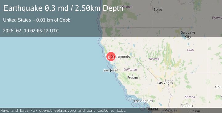
Earthquake 10 km WNW of The Geysers, CA
Thu, 19 Feb 2026 02:05:12 GMT
Time1 hour ago
Location
38.8258, -122.8533
Depth
2.5 KM
Event Summary
A 0.3 magnitude earthquake struck on 10 km WNW of The Geysers, CA, at Thu, 19 Feb 2026 02:05:12 GMT. Depth: 2.5km. Reviewed by USGS seismologists, this minor quake occurred at a magnitude type of md.
Magnitude
0.3
md
Source
USGS
Intensity
-
Agency Reports
1 Sources| Source | Magnitude | Depth | Time |
|---|---|---|---|
| USGSPrimary | 0.3 | 3 km | 1 hour ago |
Earthquake Details
AutomaticEvent IDusgs_nc75315712
Tsunami PotentialNo
Magnitude Typemd
Nearest Places
- Buckeye Mine0.5 km
- Hummingbird Creek1.5 km
- Truitt Creek1.5 km
- Alder Creek1.6 km
- Cloverdale Mine Headquarters1.7 km
Comments
Join the discussion about this event.
Latest Earthquakes
2.9Mag
Sumbawa Region, Indonesia
Time23 minutes ago
Depth53.96 km
SourceBMKG
0.8Mag
Southern Alaska
Time24 minutes ago
Depth15.50 km
SourceVYT (Automatic)
3.3Mag
Banda Sea
Time24 minutes ago
Depth161.74 km
SourceVYT (Automatic)
4.4Mag
North of Halmahera, Indonesia
Time26 minutes ago
Depth30.29 km
SourceBMKG
3.0Mag
Seram, Indonesia
Time27 minutes ago
Depth3.59 km
SourceBMKG
Nearby Earthquakes
1.5Mag
10 km WNW of The Geysers, CA
Time3 weeks ago
Depth2.37 km
SourceUSGS (Automatic)
0.4Mag
10 km WNW of The Geysers, CA
Time4 days ago
Depth2.31 km
SourceUSGS (Automatic)
0.8Mag
10 km WNW of The Geysers, CA
Time3 weeks ago
Depth2.37 km
SourceUSGS (Automatic)
2.2Mag
10 km WNW of The Geysers, CA
Time3 weeks ago
Depth1.35 km
SourceUSGS (Automatic)
1.5Mag
10 km NW of The Geysers, CA
Time2 weeks ago
Depth2.45 km
SourceUSGS (Automatic)