Earthquake KEPULAUAN BARAT DAYA, INDONESIA
Fri, 06 Nov 2020 06:20:06 GMT
Time5 years ago
Location
-7.5200, 128.3800
Depth
133.0 KM
Event Summary
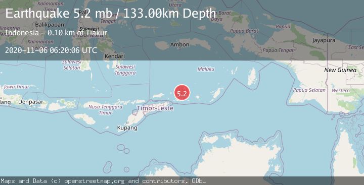
A 5.2 magnitude earthquake struck on KEPULAUAN BARAT DAYA, INDONESIA, at Fri, 06 Nov 2020 06:20:06 GMT. Depth: 133km. Reviewed by EMSC seismologists, this moderate quake occurred at a magnitude type of mb.
Magnitude
5.2
mb
Source
EMSC
Intensity
-
Agency Reports
1 Sources| Source | Magnitude | Depth | Time |
|---|---|---|---|
| EMSCPrimary | 5.2 | 133 km | 5 years ago |
Earthquake Details
AutomaticEvent IDemsc_EMSC_20201106_0000047
Tsunami PotentialNo
Magnitude Typemb
Nearest Places
- Pulau Terbang Selatan25.9 km
- Pulau Terbang Utara31.9 km
- Pulau Musleur33.5 km
- Kepulauan Barat Daya43.4 km
- Tanjung Paran44.3 km
Comments
Join the discussion about this event.
Latest Earthquakes
3.9Mag
Halmahera, Indonesia
Time3 minutes ago
Depth161.01 km
SourceVYT (Automatic)
1.0Mag
3 km W of Cobb, CA
Time5 minutes ago
Depth2.45 km
SourceUSGS (Automatic)
3.1Mag
SPAIN
Time8 minutes ago
Depth5.00 km
SourceIGN (Automatic)
2.3Mag
Tarapaca, Chile
Time9 minutes ago
Depth115.60 km
SourceVYT (Automatic)
1.2Mag
19 km NNE of Indio, CA
Time12 minutes ago
Depth4.86 km
SourceUSGS (Automatic)
Nearby Earthquakes
5.3Mag
KEPULAUAN BARAT DAYA, INDONESIA
Time9 years ago
Depth178.00 km
SourceEMSC (Automatic)
5.1Mag
KEPULAUAN BARAT DAYA, INDONESIA
Time4 years ago
Depth131.00 km
SourceEMSC (Automatic)
5.1Mag
KEPULAUAN BARAT DAYA, INDONESIA
Time12 years ago
Depth187.00 km
SourceEMSC (Automatic)
5.0Mag
KEPULAUAN BARAT DAYA, INDONESIA
Time14 years ago
Depth187.00 km
SourceEMSC (Automatic)
5.5Mag
KEPULAUAN BARAT DAYA, INDONESIA
Time17 years ago
Depth107.00 km
SourceEMSC (Automatic)