Earthquake KEPULAUAN BARAT DAYA, INDONESIA
Thu, 18 Aug 2016 11:19:18 GMT
Time9 years ago
Location
-7.5100, 128.3600
Depth
178.0 KM
Event Summary
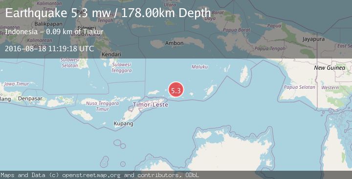
A 5.3 magnitude earthquake struck on KEPULAUAN BARAT DAYA, INDONESIA, at Thu, 18 Aug 2016 11:19:18 GMT. Depth: 178km. Reviewed by EMSC seismologists, this moderate quake occurred at a magnitude type of mw.
Magnitude
5.3
mw
Source
EMSC
Intensity
-
Agency Reports
1 Sources| Source | Magnitude | Depth | Time |
|---|---|---|---|
| EMSCPrimary | 5.3 | 178 km | 9 years ago |
Earthquake Details
AutomaticEvent IDemsc_EMSC_20160818_0000054
Tsunami PotentialNo
Magnitude Typemw
Nearest Places
- Pulau Terbang Selatan26.9 km
- Pulau Terbang Utara32.5 km
- Pulau Musleur32.6 km
- Kepulauan Barat Daya41.0 km
- Tanjung Paran44.9 km
Comments
Join the discussion about this event.
Latest Earthquakes
3.8Mag
Tarapaca, Chile
Time3 minutes ago
Depth93.51 km
SourceVYT (Automatic)
2.5Mag
Ceram Sea
Time5 minutes ago
Depth3.27 km
SourceBMKG
2.1Mag
Halmahera, Indonesia
Time7 minutes ago
Depth4.45 km
SourceBMKG
3.4Mag
Talaud Islands, Indonesia
Time11 minutes ago
Depth98.99 km
SourceBMKG
2.1Mag
Flores Region, Indonesia
Time12 minutes ago
Depth165.90 km
SourceBMKG
Nearby Earthquakes
5.1Mag
KEPULAUAN BARAT DAYA, INDONESIA
Time4 years ago
Depth131.00 km
SourceEMSC (Automatic)
5.2Mag
KEPULAUAN BARAT DAYA, INDONESIA
Time5 years ago
Depth133.00 km
SourceEMSC (Automatic)
5.9Mag
KEPULAUAN BARAT DAYA, INDONESIA
Time4 years ago
Depth134.00 km
SourceEMSC (Automatic)
5.0Mag
KEPULAUAN BARAT DAYA, INDONESIA
Time17 years ago
Depth144.00 km
SourceEMSC (Automatic)
5.1Mag
KEPULAUAN BARAT DAYA, INDONESIA
Time12 years ago
Depth187.00 km
SourceEMSC (Automatic)