Earthquake SOUTHERN SUMATRA, INDONESIA
Wed, 18 Nov 2020 04:42:01 GMT
Time5 years ago
Location
-1.7800, 100.4800
Depth
60.0 KM
Event Summary
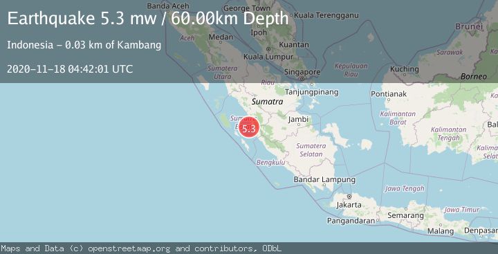
A 5.3 magnitude earthquake struck on SOUTHERN SUMATRA, INDONESIA, at Wed, 18 Nov 2020 04:42:01 GMT. Depth: 60km. Reviewed by EMSC seismologists, this moderate quake occurred at a magnitude type of mw.
Magnitude
5.3
mw
Source
EMSC
Intensity
-
Agency Reports
1 Sources| Source | Magnitude | Depth | Time |
|---|---|---|---|
| EMSCPrimary | 5.3 | 60 km | 5 years ago |
Earthquake Details
AutomaticEvent IDemsc_EMSC_20201118_0000029
Tsunami PotentialNo
Magnitude Typemw
Nearest Places
- Pulau Karaba Besar13.3 km
- Pulau Gosong14.5 km
- Pulau Katangkatang15.1 km
- Pulau Karaba Kecil22.4 km
- Pulau Baringin22.8 km
Comments
Join the discussion about this event.
Latest Earthquakes
2.0Mag
Kenai Peninsula, Alaska
Time1 minute ago
Depth72.27 km
SourceVYT (Automatic)
2.0Mag
Central Alaska
Time4 minutes ago
Depth216.92 km
SourceVYT (Automatic)
1.8Mag
Region Metropolitana, Chile
Time8 minutes ago
Depth14.89 km
SourceVYT (Automatic)
4.9Mag
Kepulauan Aru region, Indonesia
Time9 minutes ago
Depth0.00 km
SourceVYT (Automatic)
2.5Mag
Poland
Time9 minutes ago
Depth0.24 km
SourceVYT (Automatic)
Nearby Earthquakes
5.0Mag
SOUTHERN SUMATRA, INDONESIA
Time3 years ago
Depth60.00 km
SourceEMSC (Automatic)
3.5Mag
Southern Sumatra, Indonesia
Time2 weeks ago
Depth20.50 km
SourceBMKG (Automatic)
4.0Mag
SOUTHERN SUMATRA, INDONESIA
Time7 years ago
Depth10.00 km
SourceDJA (Automatic)
3.0Mag
SOUTHERN SUMATRA, INDONESIA
Time4 years ago
Depth28.00 km
SourceDJA (Automatic)
3.0Mag
SOUTHERN SUMATRA, INDONESIA
Time2 years ago
Depth33.00 km
SourceBMKG (Automatic)