Earthquake HALMAHERA, INDONESIA
Wed, 13 Jan 2021 17:33:03 GMT
Time5 years ago
Location
1.6400, 128.1700
Depth
10.0 KM
Event Summary
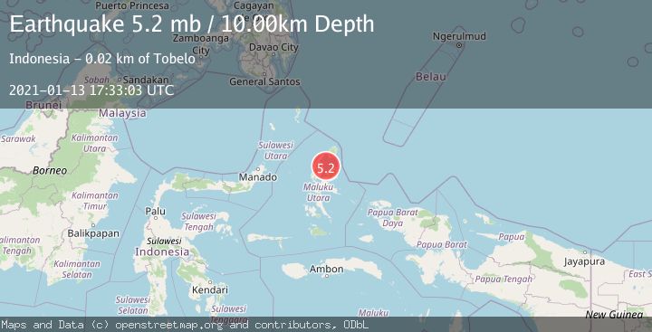
A 5.2 magnitude earthquake struck on HALMAHERA, INDONESIA, at Wed, 13 Jan 2021 17:33:03 GMT. Depth: 10km. Reviewed by EMSC seismologists, this moderate quake occurred at a magnitude type of mb.
Magnitude
5.2
mb
Source
EMSC
Intensity
-
Agency Reports
1 Sources| Source | Magnitude | Depth | Time |
|---|---|---|---|
| EMSCPrimary | 5.2 | 10 km | 5 years ago |
Earthquake Details
AutomaticEvent IDemsc_EMSC_20210113_0000139
Tsunami PotentialNo
Magnitude Typemb
Nearest Places
- Pulau Tuputupu13.1 km
- Pulau Kolorai13.5 km
- Patola14.2 km
- Pulau Miti15.0 km
- Desa Tagalaya15.0 km
Comments
Join the discussion about this event.
Latest Earthquakes
2.8Mag
Sulawesi, Indonesia
Time3 minutes ago
Depth21.08 km
SourceBMKG
2.1Mag
WESTERN TURKEY
Time7 minutes ago
Depth12.30 km
SourceKOERI (Automatic)
2.2Mag
Alaska Peninsula
Time7 minutes ago
Depth57.74 km
SourceVYT (Automatic)
3.8Mag
WESTERN TURKEY
Time10 minutes ago
Depth13.30 km
SourceKOERI (Automatic)
1.6Mag
27 km ESE of Balmorhea, Texas
Time10 minutes ago
Depth3.56 km
SourceUSGS (Automatic)
Nearby Earthquakes
5.3Mag
HALMAHERA, INDONESIA
Time16 years ago
Depth94.00 km
SourceEMSC (Automatic)
5.1Mag
HALMAHERA, INDONESIA
Time3 years ago
Depth10.00 km
SourceEMSC (Automatic)
5.0Mag
HALMAHERA, INDONESIA
Time3 years ago
Depth80.00 km
SourceEMSC (Automatic)
3.0Mag
HALMAHERA, INDONESIA
Time4 years ago
Depth10.00 km
SourceDJA (Automatic)
3.8Mag
HALMAHERA, INDONESIA
Time1 month ago
Depth5.00 km
SourceBMKG (Automatic)