Earthquake SOUTH OF KERMADEC ISLANDS
Mon, 18 Jan 2021 17:40:18 GMT
Time5 years ago
Location
-33.6600, -179.0800
Depth
10.0 KM
Event Summary
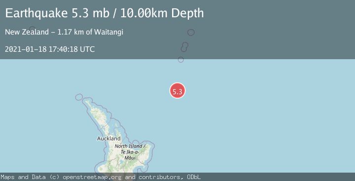
A 5.3 magnitude earthquake struck on SOUTH OF KERMADEC ISLANDS, at Mon, 18 Jan 2021 17:40:18 GMT. Depth: 10km. Reviewed by EMSC seismologists, this moderate quake occurred at a magnitude type of mb.
Magnitude
5.3
mb
Source
EMSC
Intensity
-
Agency Reports
1 Sources| Source | Magnitude | Depth | Time |
|---|---|---|---|
| EMSCPrimary | 5.3 | 10 km | 5 years ago |
Earthquake Details
AutomaticEvent IDemsc_EMSC_20210118_0000131
Tsunami PotentialNo
Magnitude Typemb
Nearest Places
- Kuiwai Seamount95.5 km
- Ngātoroirangi Seamount104.3 km
- Haungaroa Seamount126.6 km
- Star of Bengal Bank138.3 km
- Speight Knoll149.3 km
Comments
Join the discussion about this event.
Latest Earthquakes
3.6Mag
southern Sumatra, Indonesia
Time3 minutes ago
Depth13.31 km
SourceVYT (Automatic)
2.7Mag
Fox Islands, Aleutian Islands, Alaska
Time4 minutes ago
Depth0.24 km
SourceVYT (Automatic)
1.8Mag
SWITZERLAND
Time7 minutes ago
Depth7.90 km
SourceETHZ (Automatic)
2.2Mag
Sweden
Time12 minutes ago
Depth0.00 km
SourceVYT (Automatic)
2.2Mag
Alaska Peninsula
Time14 minutes ago
Depth1.71 km
SourceVYT (Automatic)
Nearby Earthquakes
5.1Mag
SOUTH OF KERMADEC ISLANDS
Time18 years ago
Depth10.00 km
SourceEMSC (Automatic)
5.3Mag
SOUTH OF KERMADEC ISLANDS
Time4 years ago
Depth41.00 km
SourceEMSC (Automatic)
5.2Mag
SOUTH OF KERMADEC ISLANDS
Time3 years ago
Depth10.00 km
SourceEMSC (Automatic)
5.0Mag
SOUTH OF KERMADEC ISLANDS
Time1 year ago
Depth35.00 km
SourceEMSC (Automatic)
4.0Mag
SOUTH OF KERMADEC ISLANDS
Time4 months ago
Depth39.50 km
SourceNEIC (Automatic)