Earthquake southern Sumatra, Indonesia
Fri, 20 Feb 2026 10:44:29 GMT
Time1 hour ago
Location
-5.2927, 102.9177
Depth
13.3 KM
Event Summary
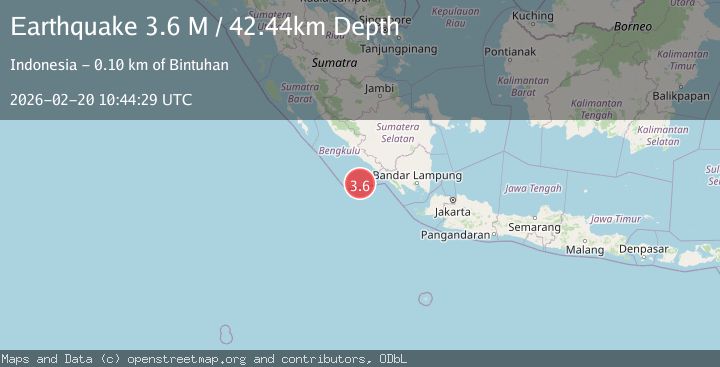
A 3.5 magnitude earthquake struck on southern Sumatra, Indonesia, at Fri, 20 Feb 2026 10:44:29 GMT. Depth: 13.3056640625km. Reviewed by VYT seismologists, this minor quake occurred at a magnitude type of earthquake.
Magnitude
3.5
earthquake
Source
VYT
Intensity
-
Agency Reports
1 Sources| Source | Magnitude | Depth | Time |
|---|---|---|---|
| VYTPrimary | 3.5 | 13 km | 1 hour ago |
Earthquake Details
AutomaticEvent IDvyt_2pw0a3ktz8j4s
Tsunami PotentialNo
Magnitude Typeearthquake
Nearest Places
- Teluk Enggano58.3 km
- Tanjung Kaana58.6 km
- Tanjung Kanuhujo58.9 km
- Pulaudua59.9 km
- Kajaapu60.6 km
Comments
Join the discussion about this event.
Latest Earthquakes
2.7Mag
Fox Islands, Aleutian Islands, Alaska
Time1 hour ago
Depth0.24 km
SourceVYT (Automatic)
2.2Mag
Sweden
Time1 hour ago
Depth0.00 km
SourceVYT (Automatic)
2.2Mag
Alaska Peninsula
Time1 hour ago
Depth1.71 km
SourceVYT (Automatic)
2.7Mag
Antofagasta, Chile
Time1 hour ago
Depth77.88 km
SourceVYT (Automatic)
1.5Mag
SWITZERLAND
Time1 hour ago
Depth0.70 km
SourceETHZ (Automatic)
Nearby Earthquakes
5.0Mag
SOUTHERN SUMATRA, INDONESIA
Time15 years ago
Depth54.00 km
SourceEMSC (Automatic)
3.0Mag
SOUTHERN SUMATRA, INDONESIA
Time2 months ago
Depth9.00 km
SourceBMKG (Automatic)
5.3Mag
SOUTHERN SUMATRA, INDONESIA
Time9 years ago
Depth52.00 km
SourceEMSC (Automatic)
3.0Mag
SOUTHERN SUMATRA, INDONESIA
Time8 months ago
Depth10.00 km
SourceBMKG (Automatic)
5.2Mag
SOUTHERN SUMATRA, INDONESIA
Time20 years ago
Depth33.00 km
SourceEMSC (Automatic)