Earthquake KEPULAUAN TALAUD, INDONESIA
Tue, 02 Feb 2021 14:37:40 GMT
Time5 years ago
Location
4.0700, 126.5900
Depth
52.0 KM
Event Summary
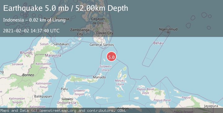
A 5.0 magnitude earthquake struck on KEPULAUAN TALAUD, INDONESIA, at Tue, 02 Feb 2021 14:37:40 GMT. Depth: 52km. Reviewed by EMSC seismologists, this moderate quake occurred at a magnitude type of mb.
Magnitude
5.0
mb
Source
EMSC
Intensity
-
Agency Reports
1 Sources| Source | Magnitude | Depth | Time |
|---|---|---|---|
| EMSCPrimary | 5.0 | 52 km | 5 years ago |
Earthquake Details
AutomaticEvent IDemsc_EMSC_20210202_0000126
Tsunami PotentialNo
Magnitude Typemb
Nearest Places
- Tanjung Salonggan3.8 km
- Desa Kalongan Utara5.0 km
- Gunung Niaro5.4 km
- Kalongan5.9 km
- Desa Kalongan7.0 km
Comments
Join the discussion about this event.
Latest Earthquakes
2.7Mag
Kenai Peninsula, Alaska
Time4 minutes ago
Depth37.60 km
SourceVYT (Automatic)
1.1Mag
Washington
Time6 minutes ago
Depth0.00 km
SourceVYT (Automatic)
3.2Mag
Region Metropolitana, Chile
Time6 minutes ago
Depth99.73 km
SourceVYT (Automatic)
2.4Mag
Sumba Region, Indonesia
Time10 minutes ago
Depth17.38 km
SourceBMKG
2.1Mag
West Papua Region, Indonesia
Time12 minutes ago
Depth10.00 km
SourceBMKG
Nearby Earthquakes
5.2Mag
KEPULAUAN TALAUD, INDONESIA
Time3 years ago
Depth10.00 km
SourceEMSC (Automatic)
5.5Mag
KEPULAUAN TALAUD, INDONESIA
Time17 years ago
Depth60.00 km
SourceEMSC (Automatic)
4.0Mag
KEPULAUAN TALAUD, INDONESIA
Time1 year ago
Depth54.00 km
SourcePIVS (Automatic)
5.5Mag
KEPULAUAN TALAUD, INDONESIA
Time19 years ago
Depth10.00 km
SourceEMSC (Automatic)
3.0Mag
KEPULAUAN TALAUD, INDONESIA
Time5 years ago
Depth39.00 km
SourceDJA (Automatic)