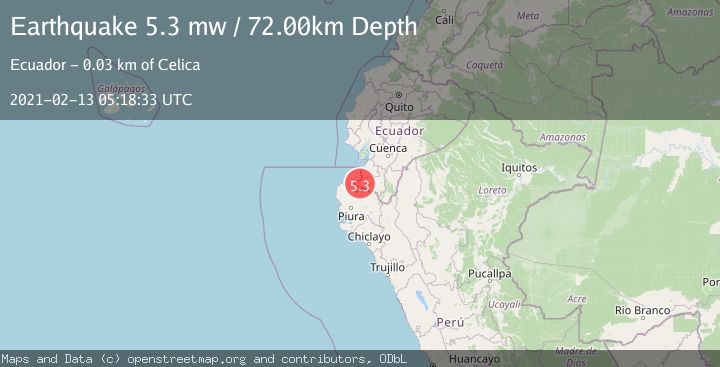
Earthquake PERU-ECUADOR BORDER REGION
Sat, 13 Feb 2021 05:18:33 GMT
Time5 years ago
Location
-4.1200, -80.2400
Depth
72.0 KM
Event Summary
A 5.3 magnitude earthquake struck on PERU-ECUADOR BORDER REGION, at Sat, 13 Feb 2021 05:18:33 GMT. Depth: 72km. Reviewed by EMSC seismologists, this moderate quake occurred at a magnitude type of mw.
Magnitude
5.3
mw
Source
EMSC
Intensity
-
Agency Reports
1 Sources| Source | Magnitude | Depth | Time |
|---|---|---|---|
| EMSCPrimary | 5.3 | 72 km | 5 years ago |
Earthquake Details
AutomaticEvent IDemsc_EMSC_20210213_0000046
Tsunami PotentialNo
Magnitude Typemw
Nearest Places
- Tablazón0.4 km
- Cerro Tambillo1.7 km
- Salvajal3.0 km
- Paletillas3.0 km
- Cerro Verde3.5 km
Comments
Join the discussion about this event.
Latest Earthquakes
1.9Mag
western Texas
Time5 minutes ago
Depth0.24 km
SourceVYT (Automatic)
2.2Mag
western Texas
Time7 minutes ago
Depth0.24 km
SourceVYT (Automatic)
2.2Mag
Valparaiso, Chile
Time9 minutes ago
Depth22.83 km
SourceVYT (Automatic)
4.5Mag
Central Alaska
Time10 minutes ago
Depth7.81 km
SourceVYT (Automatic)
1.9Mag
1 km SSW of Pāhala, Hawaii
Time14 minutes ago
Depth28.47 km
SourceUSGS (Automatic)
Nearby Earthquakes
4.0Mag
PERU-ECUADOR BORDER REGION
Time7 years ago
Depth52.00 km
SourceLIM (Automatic)
4.0Mag
PERU-ECUADOR BORDER REGION
Time4 months ago
Depth81.00 km
SourceLIM (Automatic)
5.6Mag
PERU-ECUADOR BORDER REGION
Time8 years ago
Depth60.00 km
SourceEMSC (Automatic)
4.0Mag
PERU-ECUADOR BORDER REGION
Time3 years ago
Depth66.00 km
SourceLIM (Automatic)
4.0Mag
PERU-ECUADOR BORDER REGION
Time3 years ago
Depth48.00 km
SourceNEIC (Automatic)