Earthquake PHILIPPINE ISLANDS REGION
Sat, 14 Aug 2021 01:27:40 GMT
Time4 years ago
Location
6.1200, 127.1500
Depth
26.0 KM
Event Summary
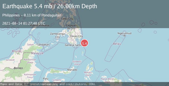
A 5.4 magnitude earthquake struck on PHILIPPINE ISLANDS REGION, at Sat, 14 Aug 2021 01:27:40 GMT. Depth: 26km. Reviewed by EMSC seismologists, this moderate quake occurred at a magnitude type of mb.
Magnitude
5.4
mb
Source
EMSC
Intensity
-
Agency Reports
1 Sources| Source | Magnitude | Depth | Time |
|---|---|---|---|
| EMSCPrimary | 5.4 | 26 km | 4 years ago |
Earthquake Details
AutomaticEvent IDemsc_EMSC_20210814_0000011
Tsunami PotentialNo
Magnitude Typemb
Nearest Places
- Tanjung Dapapa87.5 km
- Desa Pulau Miangas88.5 km
- Pulau Miangas88.5 km
- Kecamatan Miangas88.5 km
- Miangas89.3 km
Comments
Join the discussion about this event.
Latest Earthquakes
2.1Mag
Central Alaska
Time5 minutes ago
Depth29.79 km
SourceVYT (Automatic)
1.7Mag
7 km WNW of Hilltop, Texas
Time5 minutes ago
Depth9.56 km
SourceUSGS (Automatic)
2.3Mag
Tarapaca, Chile
Time6 minutes ago
Depth77.03 km
SourceVYT (Automatic)
1.2Mag
30 km WSW of Mentone, Texas
Time8 minutes ago
Depth4.42 km
SourceUSGS (Automatic)
2.2Mag
Fox Islands, Aleutian Islands, Alaska
Time13 minutes ago
Depth36.87 km
SourceVYT (Automatic)
Nearby Earthquakes
5.3Mag
PHILIPPINE ISLANDS REGION
Time4 years ago
Depth67.00 km
SourceEMSC (Automatic)
3.0Mag
PHILIPPINE ISLANDS REGION
Time4 years ago
Depth24.00 km
SourcePIVS (Automatic)
3.0Mag
PHILIPPINE ISLANDS REGION
Time3 months ago
Depth92.00 km
SourcePIVS (Automatic)
3.0Mag
PHILIPPINE ISLANDS REGION
Time4 years ago
Depth10.00 km
SourcePIVS (Automatic)
3.0Mag
PHILIPPINE ISLANDS REGION
Time2 years ago
Depth64.00 km
SourcePIVS (Automatic)