Earthquake KERMADEC ISLANDS REGION
Wed, 14 Feb 2024 23:04:50 GMT
Time2 years ago
Location
-28.1773, -177.4967
Depth
100.0 KM
Event Summary
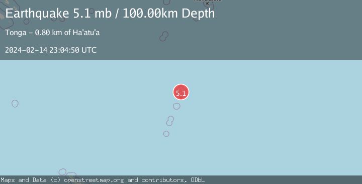
A 5.1 magnitude earthquake struck on KERMADEC ISLANDS REGION, at Wed, 14 Feb 2024 23:04:50 GMT. Depth: 100km. Reviewed by EMSC seismologists, this moderate quake occurred at a magnitude type of mb.
Magnitude
5.1
mb
Source
EMSC
Intensity
-
Agency Reports
1 Sources| Source | Magnitude | Depth | Time |
|---|---|---|---|
| EMSCPrimary | 5.1 | 100 km | 2 years ago |
Earthquake Details
AutomaticEvent IDemsc_EMSC_20240214_0000254
Tsunami PotentialNo
Magnitude Typemb
Nearest Places
- 39.0 km
- 67.2 km
- 120.2 km
- 120.2 km
- 121.5 km
Comments
Join the discussion about this event.
Latest Earthquakes
3.2Mag
Northern Molucca Sea
Time8 minutes ago
Depth4.86 km
SourceBMKG
2.3Mag
Poland
Time10 minutes ago
Depth3.05 km
SourceVYT (Automatic)
2.8Mag
Colombia-Venezuela border region
Time15 minutes ago
Depth138.55 km
SourceVYT (Automatic)
2.7Mag
Bali Sea
Time27 minutes ago
Depth17.45 km
SourceBMKG
2.2Mag
Southern California
Time32 minutes ago
Depth3.91 km
SourceVYT (Automatic)
Nearby Earthquakes
5.1Mag
KERMADEC ISLANDS REGION
Time4 years ago
Depth10.00 km
SourceEMSC (Automatic)
6.1Mag
KERMADEC ISLANDS REGION
Time4 years ago
Depth10.00 km
SourceEMSC (Automatic)
5.4Mag
KERMADEC ISLANDS REGION
Time4 years ago
Depth10.00 km
SourceEMSC (Automatic)
5.1Mag
KERMADEC ISLANDS REGION
Time4 years ago
Depth69.00 km
SourceEMSC (Automatic)
6.1Mag
KERMADEC ISLANDS REGION
Time4 years ago
Depth10.00 km
SourceEMSC (Automatic)