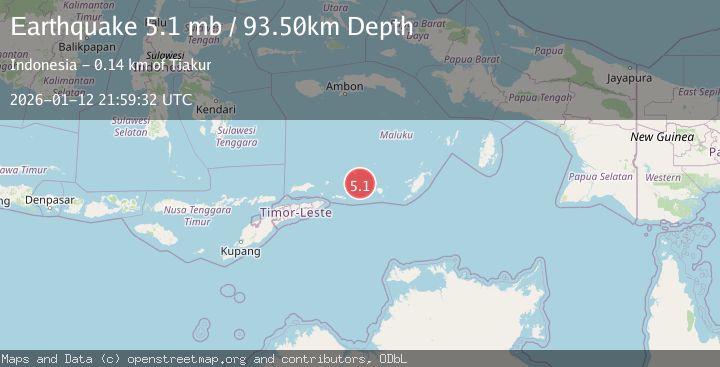
Earthquake KEPULAUAN BARAT DAYA, INDONESIA
Mon, 12 Jan 2026 21:59:32 GMT
Time1 month ago
Location
-7.5850, 128.8840
Depth
93.5 KM
Event Summary
A 5.1 magnitude earthquake struck on KEPULAUAN BARAT DAYA, INDONESIA, at Mon, 12 Jan 2026 21:59:32 GMT. Depth: 93.5km. Reviewed by EMSC seismologists, this moderate quake occurred at a magnitude type of mb.
Magnitude
5.1
mb
Source
EMSC
Intensity
-
Agency Reports
2 Sources| Source | Magnitude | Depth | Time |
|---|---|---|---|
| EMSCPrimary | 5.1 | 94 km | 1 month ago |
| BMKG | 4.1 | 142 km | 1 month ago |
Earthquake Details
AutomaticEvent IDemsc_EMSC_20260112_0000333
Tsunami PotentialNo
Magnitude Typemb
Nearest Places
- Pulau Terbang Selatan43.1 km
- Pulau Terbang Utara47.8 km
- Tanjung Paran48.9 km
- Tanjung Watlewantutu49.5 km
- Tanjung Tutuwain51.6 km
Comments
Join the discussion about this event.
Latest Earthquakes
2.3Mag
Poland
Time6 minutes ago
Depth0.00 km
SourceVYT (Automatic)
2.5Mag
FRANCE
Time6 minutes ago
Depth5.00 km
SourceReNaSS (Automatic)
0.8Mag
Southern Alaska
Time11 minutes ago
Depth3.54 km
SourceVYT (Automatic)
4.6Mag
SOUTH ATLANTIC OCEAN
Time12 minutes ago
Depth10.00 km
SourceGFZ (Automatic)
2.6Mag
Sumba Region, Indonesia
Time13 minutes ago
Depth70.14 km
SourceBMKG
Nearby Earthquakes
5.0Mag
KEPULAUAN BARAT DAYA, INDONESIA
Time16 years ago
Depth145.00 km
SourceGFZ (Automatic)
5.2Mag
KEPULAUAN BARAT DAYA, INDONESIA
Time12 years ago
Depth168.00 km
SourceEMSC (Automatic)
4.2Mag
KEPULAUAN BARAT DAYA, INDONESIA
Time1 month ago
Depth64.00 km
SourceBMKG (Automatic)
5.3Mag
KEPULAUAN BARAT DAYA, INDONESIA
Time10 years ago
Depth126.00 km
SourceEMSC (Automatic)
4.0Mag
KEPULAUAN BARAT DAYA, INDONESIA
Time1 year ago
Depth156.80 km
SourceNEIC (Automatic)