Earthquake PHILIPPINE ISLANDS REGION
Thu, 15 Jan 2026 19:50:01 GMT
Time1 month ago
Location
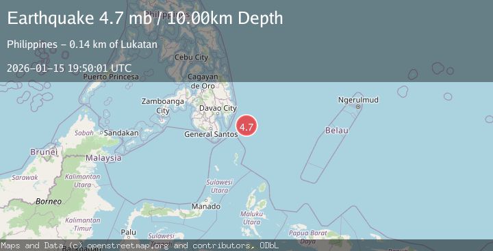
6.2984, 127.4757
Depth
10.0 KM
Event Summary
A 4.7 magnitude earthquake struck on PHILIPPINE ISLANDS REGION, at Thu, 15 Jan 2026 19:50:01 GMT. Depth: 10km. Reviewed by EMSC seismologists, this light quake occurred at a magnitude type of mb.
Magnitude
4.7
mb
Source
EMSC
Intensity
-
Agency Reports
1 Sources| Source | Magnitude | Depth | Time |
|---|---|---|---|
| EMSCPrimary | 4.7 | 10 km | 1 month ago |
Earthquake Details
AutomaticEvent IDemsc_EMSC_20260115_0000301
Tsunami PotentialNo
Magnitude Typemb
Nearest Places
- Cateel127.2 km
- Tanjung Dapapa127.5 km
- Desa Pulau Miangas128.5 km
- Pulau Miangas128.5 km
- Kecamatan Miangas128.6 km
Comments
Join the discussion about this event.
Latest Earthquakes
0.8Mag
31 km E of Coso Junction, CA
Time4 minutes ago
Depth4.01 km
SourceUSGS (Automatic)
2.0Mag
Tarapaca, Chile
Time4 minutes ago
Depth130.49 km
SourceVYT (Automatic)
2.3Mag
Southern Alaska
Time11 minutes ago
Depth46.75 km
SourceVYT (Automatic)
2.9Mag
OFFSHORE GUATEMALA
Time11 minutes ago
Depth40.00 km
SourceINET (Automatic)
3.5Mag
Western Australia
Time11 minutes ago
Depth120.24 km
SourceVYT (Automatic)
Nearby Earthquakes
3.0Mag
PHILIPPINE ISLANDS REGION
Time3 years ago
Depth90.00 km
SourcePIVS (Automatic)
3.0Mag
PHILIPPINE ISLANDS REGION
Time4 months ago
Depth16.00 km
SourcePIVS (Automatic)
6.4Mag
PHILIPPINE ISLANDS REGION
Time18 years ago
Depth2.00 km
SourceEMSC (Automatic)
3.0Mag
PHILIPPINE ISLANDS REGION
Time1 year ago
Depth2.00 km
SourcePIVS (Automatic)
3.0Mag
PHILIPPINE ISLANDS REGION
Time4 months ago
Depth41.00 km
SourcePIVS (Automatic)