Earthquake KURIL ISLANDS
Sat, 17 Jan 2026 11:44:45 GMT
Time1 month ago
Location
48.7618, 155.1021
Depth
64.0 KM
Event Summary
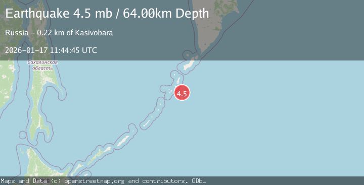
A 4.5 magnitude earthquake struck on KURIL ISLANDS, at Sat, 17 Jan 2026 11:44:45 GMT. Depth: 64km. Reviewed by EMSC seismologists, this light quake occurred at a magnitude type of mb.
Magnitude
4.5
mb
Source
EMSC
Intensity
-
Agency Reports
1 Sources| Source | Magnitude | Depth | Time |
|---|---|---|---|
| EMSCPrimary | 4.5 | 64 km | 1 month ago |
Earthquake Details
AutomaticEvent IDemsc_EMSC_20260117_0000155
Tsunami PotentialNo
Magnitude Typemb
Nearest Places
- Mys Vrubelya52.7 km
- Mys Lava52.9 km
- Mys Arutono54.7 km
- Ozera Solenyye54.9 km
- Ostrov Kharimkotan57.7 km
Comments
Join the discussion about this event.
Latest Earthquakes
2.1Mag
northern Alaska
Time3 minutes ago
Depth0.00 km
SourceVYT (Automatic)
2.9Mag
Seram, Indonesia
Time12 minutes ago
Depth15.78 km
SourceBMKG
2.5Mag
Java, Indonesia
Time13 minutes ago
Depth115.38 km
SourceBMKG
1.4Mag
7 km NW of The Geysers, CA
Time17 minutes ago
Depth1.65 km
SourceUSGS (Automatic)
1.1Mag
7 km NE of San Jacinto, CA
Time22 minutes ago
Depth16.11 km
SourceUSGS (Automatic)
Nearby Earthquakes
4.0Mag
KURIL ISLANDS
Time6 years ago
Depth40.00 km
SourceOBN (Automatic)
5.0Mag
KURIL ISLANDS
Time5 years ago
Depth60.00 km
SourceEMSC (Automatic)
6.1Mag
KURIL ISLANDS
Time4 years ago
Depth30.00 km
SourceEMSC (Automatic)
5.6Mag
KURIL ISLANDS
Time4 months ago
Depth16.70 km
SourceEMSC (Automatic)
5.3Mag
KURIL ISLANDS
Time12 years ago
Depth45.00 km
SourceEMSC (Automatic)