Earthquake SOUTH OF SUMBAWA, INDONESIA
Mon, 19 Jan 2026 13:15:46 GMT
Time1 month ago
Location
-11.4337, 118.5610
Depth
10.0 KM
Event Summary
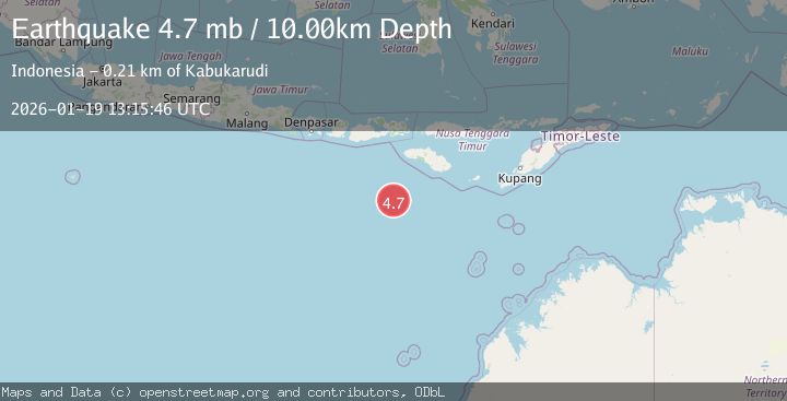
A 4.7 magnitude earthquake struck on SOUTH OF SUMBAWA, INDONESIA, at Mon, 19 Jan 2026 13:15:46 GMT. Depth: 10km. Reviewed by EMSC seismologists, this light quake occurred at a magnitude type of mb.
Magnitude
4.7
mb
Source
EMSC
Intensity
-
Agency Reports
1 Sources| Source | Magnitude | Depth | Time |
|---|---|---|---|
| EMSCPrimary | 4.7 | 10 km | 1 month ago |
Earthquake Details
AutomaticEvent IDemsc_EMSC_20260119_0000159
Tsunami PotentialNo
Magnitude Typemb
Nearest Places
- Corona Bank106.0 km
- Watu Kalode198.9 km
- Tanjung Mambang199.2 km
- Tanjung Toroha199.3 km
- Tanjung Matogola199.4 km
Comments
Join the discussion about this event.
Latest Earthquakes
1.6Mag
Kenai Peninsula, Alaska
Time8 minutes ago
Depth42.60 km
SourceVYT (Automatic)
2.4Mag
Finland
Time10 minutes ago
Depth301.88 km
SourceVYT (Automatic)
1.2Mag
Alaska Peninsula
Time11 minutes ago
Depth0.12 km
SourceVYT (Automatic)
2.6Mag
SAN JUAN, ARGENTINA
Time12 minutes ago
Depth92.00 km
SourceNSNA (Automatic)
4.1Mag
NEAR COAST OF NORTHERN PERU
Time16 minutes ago
Depth35.00 km
SourceLIM (Automatic)
Nearby Earthquakes
5.0Mag
SOUTH OF SUMBAWA, INDONESIA
Time19 years ago
Depth30.00 km
SourceEMSC (Automatic)
4.0Mag
SOUTH OF SUMBAWA, INDONESIA
Time6 years ago
Depth10.00 km
SourceDJA (Automatic)
5.2Mag
SOUTH OF SUMBAWA, INDONESIA
Time6 years ago
Depth10.00 km
SourceEMSC (Automatic)
5.8Mag
SOUTH OF SUMBAWA, INDONESIA
Time19 years ago
Depth10.00 km
SourceEMSC (Automatic)
5.1Mag
SOUTH OF SUMBAWA, INDONESIA
Time6 years ago
Depth10.00 km
SourceEMSC (Automatic)