Earthquake TIMOR REGION, INDONESIA
Wed, 02 Jan 2008 21:01:05 GMT
Time18 years ago
Location
-9.3900, 123.6100
Depth
72.0 KM
Event Summary
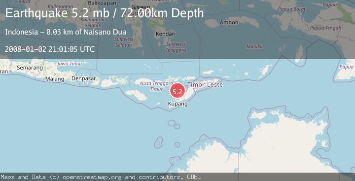
A 5.2 magnitude earthquake struck on TIMOR REGION, INDONESIA, at Wed, 02 Jan 2008 21:01:05 GMT. Depth: 72km. Reviewed by GFZ seismologists, this moderate quake occurred at a magnitude type of mb.
Magnitude
5.2
mb
Source
GFZ
Intensity
-
Agency Reports
1 Sources| Source | Magnitude | Depth | Time |
|---|---|---|---|
| GFZPrimary | 5.2 | 72 km | 18 years ago |
Earthquake Details
AutomaticEvent IDemsc_GFZ_20080102_0000089
Tsunami PotentialNo
Magnitude Typemb
Nearest Places
- Nuaf Panmolo23.8 km
- Nono Oelpasi23.8 km
- Kapuktulis23.9 km
- Tanjung Naibonat24.1 km
- Tanjung Gumuk24.2 km
Comments
Join the discussion about this event.
Latest Earthquakes
1.9Mag
Central Alaska
Time7 hours ago
Depth87.40 km
SourceVYT (Automatic)
0.4Mag
6 km NNW of The Geysers, CA
Time7 hours ago
Depth1.69 km
SourceUSGS (Automatic)
2.0Mag
Arizona
Time7 hours ago
Depth12.94 km
SourceVYT (Automatic)
2.5Mag
Antofagasta, Chile
Time7 hours ago
Depth0.24 km
SourceVYT (Automatic)
1.2Mag
39 km SSE of Whittier, Alaska
Time7 hours ago
Depth5.00 km
SourceUSGS (Automatic)
Nearby Earthquakes
4.0Mag
TIMOR REGION, INDONESIA
Time1 year ago
Depth10.00 km
SourceBMKG (Automatic)
2.6Mag
Timor Region
Time1 week ago
Depth16.69 km
SourceBMKG (Automatic)
3.0Mag
TIMOR REGION, INDONESIA
Time3 years ago
Depth27.00 km
SourceDJA (Automatic)
3.6Mag
Timor region, Indonesia
Time1 week ago
Depth1.95 km
SourceVYT (Automatic)
5.0Mag
TIMOR REGION, INDONESIA
Time6 years ago
Depth83.00 km
SourceEMSC (Automatic)