Earthquake KEPULAUAN BARAT DAYA, INDONESIA
Sun, 30 Mar 2008 13:10:06 GMT
Time17 years ago
Location
-7.7900, 127.8600
Depth
146.0 KM
Event Summary
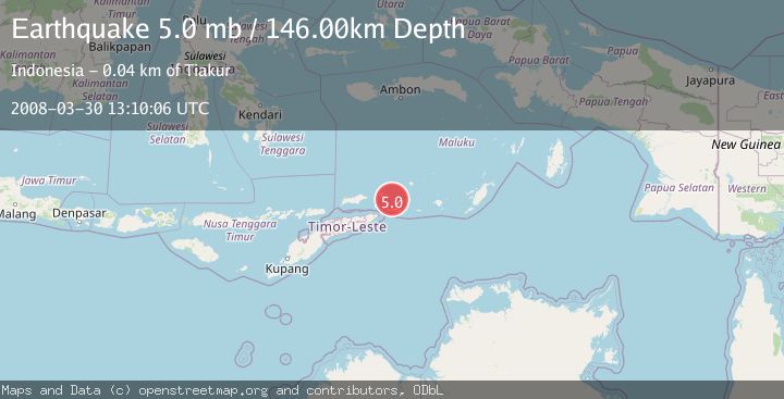
A 5.0 magnitude earthquake struck on KEPULAUAN BARAT DAYA, INDONESIA, at Sun, 30 Mar 2008 13:10:06 GMT. Depth: 146km. Reviewed by GFZ seismologists, this moderate quake occurred at a magnitude type of mb.
Magnitude
5.0
mb
Source
GFZ
Intensity
-
Agency Reports
1 Sources| Source | Magnitude | Depth | Time |
|---|---|---|---|
| GFZPrimary | 5.0 | 146 km | 17 years ago |
Earthquake Details
AutomaticEvent IDemsc_GFZ_20080330_0000065
Tsunami PotentialNo
Magnitude Typemb
Nearest Places
- Pulau Juha33.3 km
- Tanjung Liyiar34.5 km
- Tanjung Serbatang35.4 km
- Tanjung Tutepapau35.8 km
- Kaiwatu35.9 km
Comments
Join the discussion about this event.
Latest Earthquakes
1.4Mag
17 km S of Tres Pinos, CA
Time5 minutes ago
Depth5.12 km
SourceUSGS (Automatic)
1.8Mag
Southern Alaska
Time7 minutes ago
Depth0.00 km
SourceVYT (Automatic)
2.0Mag
Java, Indonesia
Time12 minutes ago
Depth5.00 km
SourceBMKG
0.7Mag
2 km SE of Loma Linda, CA
Time20 minutes ago
Depth3.87 km
SourceUSGS (Automatic)
2.3Mag
Sulawesi, Indonesia
Time22 minutes ago
Depth5.74 km
SourceBMKG
Nearby Earthquakes
3.9Mag
Banda Sea
Time1 week ago
Depth134.38 km
SourceBMKG
4.0Mag
KEPULAUAN BARAT DAYA, INDONESIA
Time3 months ago
Depth117.00 km
SourceBMKG (Automatic)
5.6Mag
Banda Sea
Time3 weeks ago
Depth179.61 km
SourceBMKG (Automatic)
3.4Mag
KEPULAUAN BARAT DAYA, INDONESIA
Time1 month ago
Depth164.00 km
SourceBMKG (Automatic)
5.4Mag
KEPULAUAN BARAT DAYA, INDONESIA
Time4 years ago
Depth85.00 km
SourceEMSC (Automatic)