Earthquake 17 km S of Tres Pinos, CA
Thu, 19 Feb 2026 07:50:47 GMT
Time1 hour ago
Location
36.6413, -121.2897
Depth
5.1 KM
Event Summary
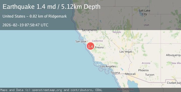
A 1.4 magnitude earthquake struck on 17 km S of Tres Pinos, CA, at Thu, 19 Feb 2026 07:50:47 GMT. Depth: 5.11999988555908km. Reviewed by USGS seismologists, this minor quake occurred at a magnitude type of md.
Magnitude
1.4
md
Source
USGS
Intensity
-
Agency Reports
1 Sources| Source | Magnitude | Depth | Time |
|---|---|---|---|
| USGSPrimary | 1.4 | 5 km | 1 hour ago |
Earthquake Details
AutomaticEvent IDusgs_nc75315762
Tsunami PotentialNo
Magnitude Typemd
Nearest Places
- Alvisa Canyon0.1 km
- Three Troughs Canyon0.7 km
- Bear Canyon2.7 km
- Live Oak School (historical)3.9 km
- Gabilan Range4.0 km
Comments
Join the discussion about this event.
Latest Earthquakes
1.6Mag
49 km W of Mentone, Texas
Time10 minutes ago
Depth3.28 km
SourceUSGS (Automatic)
1.5Mag
Central Alaska
Time11 minutes ago
Depth17.82 km
SourceVYT (Automatic)
2.2Mag
SAN FRANCISCO BAY AREA, CALIF.
Time13 minutes ago
Depth6.70 km
SourceNC (Automatic)
1.9Mag
western Texas
Time15 minutes ago
Depth0.00 km
SourceVYT (Automatic)
1.9Mag
Tarapaca, Chile
Time16 minutes ago
Depth71.29 km
SourceVYT (Automatic)
Nearby Earthquakes
2.7Mag
CENTRAL CALIFORNIA
Time2 days ago
Depth6.00 km
SourceNC (Automatic)
1.3Mag
17 km S of Tres Pinos, CA
Time2 weeks ago
Depth6.61 km
SourceUSGS (Automatic)
1.5Mag
17 km S of Tres Pinos, CA
Time3 weeks ago
Depth5.66 km
SourceUSGS (Automatic)
2.7Mag
17 km S of Tres Pinos, CA
Time2 weeks ago
Depth5.59 km
SourceUSGS (Automatic)
1.2Mag
17 km S of Tres Pinos, CA
Time2 weeks ago
Depth5.50 km
SourceUSGS (Automatic)