Earthquake KURIL ISLANDS
Thu, 12 Feb 2026 16:45:02 GMT
Time1 week ago
Location
44.0160, 148.9100
Depth
18.0 KM
Event Summary
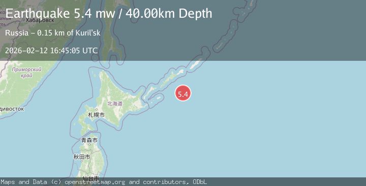
A 5.8 magnitude earthquake struck on KURIL ISLANDS, at Thu, 12 Feb 2026 16:45:02 GMT. Depth: 18km. Reviewed by GFZ seismologists, this moderate quake occurred at a magnitude type of mb.
Magnitude
5.8
mb
Source
GFZ
Intensity
-
Agency Reports
5 Sources| Source | Magnitude | Depth | Time |
|---|---|---|---|
| GFZPrimary | 5.8 | 18 km | 1 week ago |
| EMSC | 5.8 | 35 km | 1 week ago |
| NEIC | 5.4 | 10 km | 1 week ago |
| USGS | 5.4 | 10 km | 1 week ago |
| GSRAS | 5.4 | 40 km | 1 week ago |
Earthquake Details
AutomaticEvent IDemsc_GFZ_20260212_0000207
Tsunami PotentialNo
Magnitude Typemb
Nearest Places
- 132.0 km
- 132.2 km
- 132.3 km
- 132.3 km
- 132.4 km
Comments
Join the discussion about this event.
Latest Earthquakes
2.5Mag
South of Java, Indonesia
Time14 hours ago
Depth162.67 km
SourceBMKG
0.6Mag
9 km NW of The Geysers, CA
Time14 hours ago
Depth2.06 km
SourceUSGS (Automatic)
1.2Mag
WESTERN TURKEY
Time14 hours ago
Depth7.60 km
SourceAFAD (Automatic)
3.5Mag
Flores region, Indonesia
Time14 hours ago
Depth638.55 km
SourceVYT (Automatic)
3.2Mag
South of Java, Indonesia
Time14 hours ago
Depth64.99 km
SourceBMKG
Nearby Earthquakes
4.8Mag
EAST OF KURIL ISLANDS
Time4 days ago
Depth10.00 km
SourceGFZ (Automatic)
5.2Mag
EAST OF KURIL ISLANDS
Time1 year ago
Depth6.30 km
SourceEMSC (Automatic)
5.5Mag
KURIL ISLANDS
Time1 week ago
Depth35.00 km
SourceEMSC (Automatic)
5.1Mag
KURIL ISLANDS
Time12 years ago
Depth13.00 km
SourceEMSC (Automatic)
5.1Mag
KURIL ISLANDS
Time1 week ago
Depth35.00 km
SourceEMSC (Automatic)