Earthquake SOUTH OF KERMADEC ISLANDS
Thu, 17 Jun 2021 20:33:44 GMT
Time4 years ago
Location
-33.1000, 179.8600
Depth
603.0 KM
Event Summary
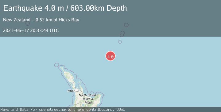
A 4.0 magnitude earthquake struck on SOUTH OF KERMADEC ISLANDS, at Thu, 17 Jun 2021 20:33:44 GMT. Depth: 603km. Reviewed by GNS seismologists, this light quake occurred at a magnitude type of m.
Magnitude
4.0
m
Source
GNS
Intensity
-
Agency Reports
1 Sources| Source | Magnitude | Depth | Time |
|---|---|---|---|
| GNSPrimary | 4.0 | 603 km | 4 years ago |
Earthquake Details
AutomaticEvent IDemsc_GNS_20210617_0000220
Tsunami PotentialNo
Magnitude Typem
Nearest Places
- Kuiwai Seamount21.6 km
- Ngātoroirangi Seamount70.9 km
- Haungaroa Seamount71.2 km
- Oliver Knoll89.8 km
- Speight Knoll94.5 km
Comments
Join the discussion about this event.
Latest Earthquakes
1.8Mag
western Texas
Time2 minutes ago
Depth0.00 km
SourceVYT (Automatic)
2.1Mag
Sulawesi, Indonesia
Time4 minutes ago
Depth5.00 km
SourceBMKG
2.4Mag
SAN FRANCISCO BAY AREA, CALIF.
Time4 minutes ago
Depth14.90 km
SourceNC (Automatic)
1.1Mag
10 km WNW of The Geysers, CA
Time7 minutes ago
Depth2.07 km
SourceUSGS (Automatic)
1.6Mag
Southern Alaska
Time11 minutes ago
Depth0.12 km
SourceVYT (Automatic)
Nearby Earthquakes
6.0Mag
SOUTH OF KERMADEC ISLANDS
Time15 years ago
Depth170.00 km
SourceEMSC (Automatic)
4.0Mag
SOUTH OF KERMADEC ISLANDS
Time2 years ago
Depth357.00 km
SourceGNS (Automatic)
5.5Mag
SOUTH OF KERMADEC ISLANDS
Time6 years ago
Depth129.00 km
SourceEMSC (Automatic)
5.1Mag
SOUTH OF KERMADEC ISLANDS
Time7 years ago
Depth246.00 km
SourceEMSC (Automatic)
4.0Mag
SOUTH OF KERMADEC ISLANDS
Time1 year ago
Depth189.40 km
SourceGNS (Automatic)