Earthquake SOUTH OF KERMADEC ISLANDS
Mon, 17 Feb 2020 00:28:12 GMT
Time6 years ago
Location
-33.0800, -179.9900
Depth
129.0 KM
Event Summary
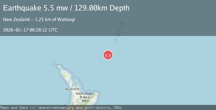
A 5.5 magnitude earthquake struck on SOUTH OF KERMADEC ISLANDS, at Mon, 17 Feb 2020 00:28:12 GMT. Depth: 129km. Reviewed by EMSC seismologists, this moderate quake occurred at a magnitude type of mw.
Magnitude
5.5
mw
Source
EMSC
Intensity
-
Agency Reports
1 Sources| Source | Magnitude | Depth | Time |
|---|---|---|---|
| EMSCPrimary | 5.5 | 129 km | 6 years ago |
Earthquake Details
AutomaticEvent IDemsc_EMSC_20200217_0000002
Tsunami PotentialNo
Magnitude Typemw
Nearest Places
- Kuiwai Seamount11.4 km
- Haungaroa Seamount61.0 km
- Ngātoroirangi Seamount75.5 km
- Oliver Knoll81.8 km
- Speight Knoll85.7 km
Comments
Join the discussion about this event.
Latest Earthquakes
1.1Mag
10 km WNW of The Geysers, CA
Time2 minutes ago
Depth2.07 km
SourceUSGS (Automatic)
1.6Mag
Southern Alaska
Time6 minutes ago
Depth0.12 km
SourceVYT (Automatic)
1.5Mag
Southeastern Alaska
Time9 minutes ago
Depth13.67 km
SourceVYT (Automatic)
4.8Mag
offshore Coquimbo, Chile
Time11 minutes ago
Depth0.00 km
SourceVYT (Automatic)
3.4Mag
Timor Region
Time11 minutes ago
Depth128.23 km
SourceBMKG
Nearby Earthquakes
4.0Mag
SOUTH OF KERMADEC ISLANDS
Time4 years ago
Depth603.00 km
SourceGNS (Automatic)
6.0Mag
SOUTH OF KERMADEC ISLANDS
Time15 years ago
Depth170.00 km
SourceEMSC (Automatic)
4.0Mag
SOUTH OF KERMADEC ISLANDS
Time1 year ago
Depth189.40 km
SourceGNS (Automatic)
5.1Mag
SOUTH OF KERMADEC ISLANDS
Time7 years ago
Depth246.00 km
SourceEMSC (Automatic)
4.0Mag
SOUTH OF KERMADEC ISLANDS
Time2 years ago
Depth357.00 km
SourceGNS (Automatic)