Earthquake NORTH ISLAND OF NEW ZEALAND
Mon, 26 Jan 2026 08:10:12 GMT
Time1 day ago
Location
-39.4174, 174.4079
Depth
131.2 KM
Event Summary
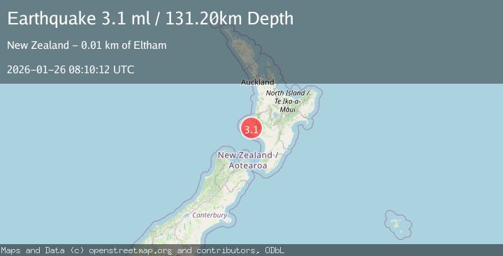
A 3.1 magnitude earthquake struck on NORTH ISLAND OF NEW ZEALAND, at Mon, 26 Jan 2026 08:10:12 GMT. Depth: 131.2km. Reviewed by GNS seismologists, this minor quake occurred at a magnitude type of ml.
Magnitude
3.1
ml
Source
GNS
Intensity
-
Agency Reports
1 Sources| Source | Magnitude | Depth | Time |
|---|---|---|---|
| GNSPrimary | 3.1 | 131 km | 1 day ago |
Earthquake Details
AutomaticEvent IDemsc_GNS_20260126_0000143
Tsunami PotentialNo
Magnitude Typeml
Nearest Places
- Rahui0.8 km
- Mangamingi Stream1.2 km
- Rahui Stream1.5 km
- Rahui2.1 km
- Mangamingi2.2 km
Comments
Join the discussion about this event.
Latest Earthquakes
0.7Mag
22 km NE of Four Mile Road, Alaska
Time4 hours ago
Depth28.90 km
SourceUSGS (Automatic)
4.3Mag
Java, Indonesia
Time4 hours ago
Depth37.35 km
SourceBMKG (Automatic)
2.2Mag
SWITZERLAND
Time4 hours ago
Depth12.20 km
SourceReNaSS (Automatic)
2.3Mag
Java, Indonesia
Time4 hours ago
Depth11.91 km
SourceBMKG (Automatic)
3.0Mag
51 km SE of Bettles, Alaska
Time4 hours ago
Depth5.10 km
SourceUSGS (Automatic)
Nearby Earthquakes
3.2Mag
NORTH ISLAND OF NEW ZEALAND
Time1 day ago
Depth178.90 km
SourceGNS (Automatic)
3.3Mag
NORTH ISLAND OF NEW ZEALAND
Time5 days ago
Depth221.10 km
SourceGNS (Automatic)
3.5Mag
NORTH ISLAND OF NEW ZEALAND
Time2 days ago
Depth16.90 km
SourceGNS (Automatic)
4.4Mag
COOK STRAIT, NEW ZEALAND
Time11 hours ago
Depth24.80 km
SourceGNS (Automatic)
3.5Mag
NORTH ISLAND OF NEW ZEALAND
Time2 days ago
Depth199.30 km
SourceGNS (Automatic)