Earthquake COOK STRAIT, NEW ZEALAND
Tue, 27 Jan 2026 00:53:34 GMT
Time11 hours ago
Location
-40.4458, 174.7939
Depth
24.8 KM
Event Summary
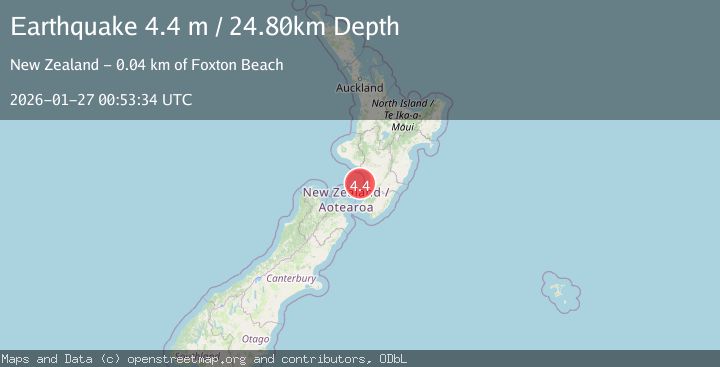
A 4.4 magnitude earthquake struck on COOK STRAIT, NEW ZEALAND, at Tue, 27 Jan 2026 00:53:34 GMT. Depth: 24.8km. Reviewed by GNS seismologists, this light quake occurred at a magnitude type of m.
Magnitude
4.4
m
Source
GNS
Intensity
-
Agency Reports
1 Sources| Source | Magnitude | Depth | Time |
|---|---|---|---|
| GNSPrimary | 4.4 | 25 km | 11 hours ago |
Earthquake Details
AutomaticEvent IDemsc_GNS_20260127_0000012
Tsunami PotentialNo
Magnitude Typem
Nearest Places
- Manawatu River35.5 km
- Hydrabad36.0 km
- WAITARERE FOREST36.2 km
- Waitarere36.2 km
- Wairarawa Stream36.2 km
Comments
Join the discussion about this event.
Latest Earthquakes
3.7Mag
West Papua, Indonesia
Time11 hours ago
Depth73.14 km
SourceBMKG (Automatic)
3.7Mag
Talaud Islands, Indonesia
Time11 hours ago
Depth129.80 km
SourceBMKG (Automatic)
0.8Mag
9 km WNW of The Geysers, CA
Time11 hours ago
Depth1.50 km
SourceUSGS (Automatic)
5.0Mag
NEAR EAST COAST OF KAMCHATKA
Time11 hours ago
Depth48.00 km
SourceEMSC (Automatic)
4.0Mag
GUERRERO, MEXICO
Time11 hours ago
Depth9.80 km
SourceUNM (Automatic)
Nearby Earthquakes
3.0Mag
COOK STRAIT, NEW ZEALAND
Time6 days ago
Depth42.00 km
SourceGNS (Automatic)
3.5Mag
NORTH ISLAND OF NEW ZEALAND
Time2 days ago
Depth16.90 km
SourceGNS (Automatic)
3.1Mag
COOK STRAIT, NEW ZEALAND
Time5 days ago
Depth45.90 km
SourceGNS (Automatic)
3.0Mag
COOK STRAIT, NEW ZEALAND
Time1 day ago
Depth94.00 km
SourceGNS (Automatic)
3.7Mag
NORTH ISLAND OF NEW ZEALAND
Time1 day ago
Depth22.70 km
SourceGNS (Automatic)