Earthquake COOK STRAIT, NEW ZEALAND
Tue, 03 Feb 2026 23:35:31 GMT
Time16 hours ago
Location
-41.6383, 174.2354
Depth
8.9 KM
Event Summary
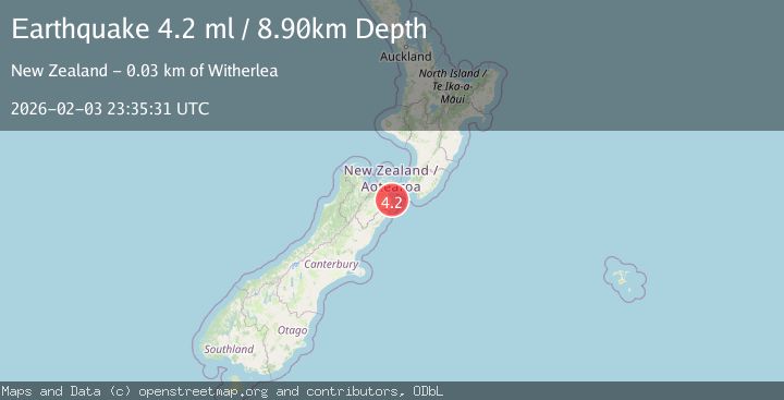
A 4.2 magnitude earthquake struck on COOK STRAIT, NEW ZEALAND, at Tue, 03 Feb 2026 23:35:31 GMT. Depth: 8.9km. Reviewed by GNS seismologists, this light quake occurred at a magnitude type of ml.
Magnitude
4.2
ml
Source
GNS
Intensity
-
Agency Reports
1 Sources| Source | Magnitude | Depth | Time |
|---|---|---|---|
| GNSPrimary | 4.2 | 9 km | 16 hours ago |
Earthquake Details
AutomaticEvent IDemsc_GNS_20260203_0000329
Tsunami PotentialNo
Magnitude Typeml
Nearest Places
- Awatere River6.2 km
- Station Creek7.1 km
- Blind River7.8 km
- Seaview7.8 km
- Ardgowan8.6 km
Comments
Join the discussion about this event.
Latest Earthquakes
1.1Mag
14 km SSE of Stanton, Texas
Time17 hours ago
Depth3.28 km
SourceUSGS (Automatic)
4.8Mag
Southern Sumatra, Indonesia
Time17 hours ago
Depth5.00 km
SourceBMKG (Automatic)
1.6Mag
11 km NNW of Nellis Air Force Base, Nevada
Time17 hours ago
Depth3.77 km
SourceUSGS (Automatic)
2.9Mag
OKLAHOMA
Time17 hours ago
Depth6.80 km
SourceOK (Automatic)
2.1Mag
HAWAII REGION, HAWAII
Time17 hours ago
Depth5.80 km
SourceHV (Automatic)
Nearby Earthquakes
3.7Mag
COOK STRAIT, NEW ZEALAND
Time1 week ago
Depth10.80 km
SourceGNS (Automatic)
3.5Mag
SOUTH ISLAND OF NEW ZEALAND
Time1 week ago
Depth15.20 km
SourceGNS (Automatic)
3.1Mag
COOK STRAIT, NEW ZEALAND
Time1 week ago
Depth45.90 km
SourceGNS (Automatic)
3.0Mag
COOK STRAIT, NEW ZEALAND
Time2 weeks ago
Depth42.00 km
SourceGNS (Automatic)
3.1Mag
SOUTH ISLAND OF NEW ZEALAND
Time1 week ago
Depth55.40 km
SourceGNS (Automatic)