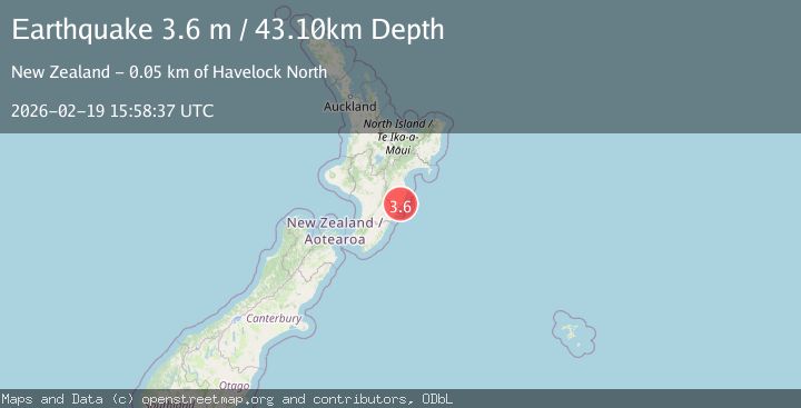
Earthquake NORTH ISLAND OF NEW ZEALAND
Thu, 19 Feb 2026 15:58:37 GMT
Time1 hour ago
Location
-40.1488, 176.7628
Depth
43.1 KM
Event Summary
A 3.6 magnitude earthquake struck on NORTH ISLAND OF NEW ZEALAND, at Thu, 19 Feb 2026 15:58:37 GMT. Depth: 43.1km. Reviewed by GNS seismologists, this minor quake occurred at a magnitude type of m.
Magnitude
3.6
m
Source
GNS
Intensity
-
Agency Reports
1 Sources| Source | Magnitude | Depth | Time |
|---|---|---|---|
| GNSPrimary | 3.6 | 43 km | 1 hour ago |
Earthquake Details
AutomaticEvent IDemsc_GNS_20260219_0000248
Tsunami PotentialNo
Magnitude Typem
Nearest Places
- Hautoki1.8 km
- Raumati1.9 km
- Long Range2.3 km
- Long Range Lake2.4 km
- Tiriroa2.5 km
Comments
Join the discussion about this event.
Latest Earthquakes
2.2Mag
Seram, Indonesia
Time1 hour ago
Depth4.61 km
SourceBMKG
0.7Mag
Southern Alaska
Time1 hour ago
Depth0.00 km
SourceVYT (Automatic)
1.4Mag
8 km N of Rancho Cucamonga, CA
Time1 hour ago
Depth3.48 km
SourceUSGS (Automatic)
2.7Mag
COQUIMBO, CHILE
Time1 hour ago
Depth47.60 km
SourceCSN (Automatic)
1.3Mag
17 km WSW of Johannesburg, CA
Time1 hour ago
Depth9.21 km
SourceUSGS (Automatic)
Nearby Earthquakes
3.0Mag
NORTH ISLAND OF NEW ZEALAND
Time11 months ago
Depth35.20 km
SourceGNS (Automatic)
3.1Mag
NORTH ISLAND OF NEW ZEALAND
Time2 weeks ago
Depth17.10 km
SourceGNS (Automatic)
3.1Mag
NORTH ISLAND OF NEW ZEALAND
Time2 weeks ago
Depth18.60 km
SourceGNS (Automatic)
5.2Mag
NORTH ISLAND OF NEW ZEALAND
Time15 years ago
Depth20.00 km
SourceEMSC (Automatic)
3.0Mag
NORTH ISLAND OF NEW ZEALAND
Time1 year ago
Depth16.00 km
SourceGNS (Automatic)