Earthquake EAST OF KURIL ISLANDS
Wed, 18 Feb 2026 10:31:26 GMT
Time2 days ago
Location
49.3900, 158.2600
Depth
50.0 KM
Event Summary
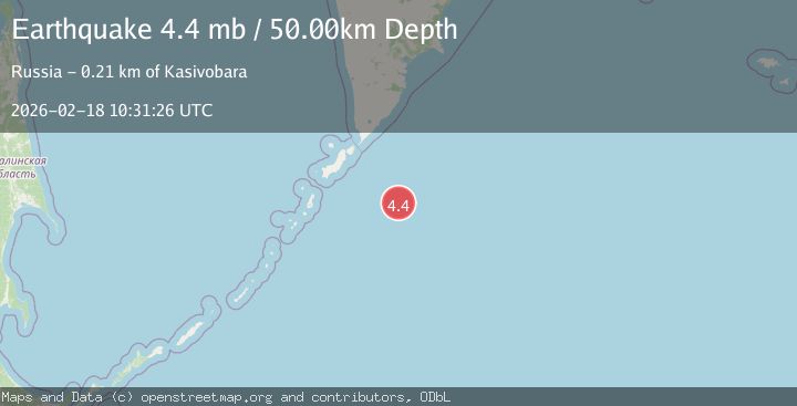
A 4.4 magnitude earthquake struck on EAST OF KURIL ISLANDS, at Wed, 18 Feb 2026 10:31:26 GMT. Depth: 50km. Reviewed by GSRAS seismologists, this light quake occurred at a magnitude type of mb.
Magnitude
4.4
mb
Source
GSRAS
Intensity
-
Agency Reports
1 Sources| Source | Magnitude | Depth | Time |
|---|---|---|---|
| GSRASPrimary | 4.4 | 50 km | 2 days ago |
Earthquake Details
AutomaticEvent IDemsc_GSRAS_20260218_0000161
Tsunami PotentialNo
Magnitude Typemb
Nearest Places
- Oyashio113.2 km
- Skala Vladimira180.6 km
- Rif Nezametnyy182.0 km
- Mel’ Koksher182.0 km
- Banka Kazach’ya186.7 km
Comments
Join the discussion about this event.
Latest Earthquakes
1.8Mag
Sweden
Time2 minutes ago
Depth0.00 km
SourceVYT (Automatic)
2.6Mag
Tarapaca, Chile
Time3 minutes ago
Depth95.70 km
SourceVYT (Automatic)
2.3Mag
Minahassa Peninsula, Sulawesi
Time5 minutes ago
Depth10.65 km
SourceBMKG
3.4Mag
Sulawesi, Indonesia
Time5 minutes ago
Depth45.17 km
SourceVYT (Automatic)
4.7Mag
Fiji region
Time6 minutes ago
Depth436.65 km
SourceVYT (Automatic)
Nearby Earthquakes
5.2Mag
EAST OF KURIL ISLANDS
Time20 years ago
Depth30.00 km
SourceEMSC (Automatic)
4.4Mag
EAST OF KURIL ISLANDS
Time2 weeks ago
Depth10.00 km
SourceGSRAS (Automatic)
4.0Mag
EAST OF KURIL ISLANDS
Time9 months ago
Depth10.00 km
SourceGSRAS (Automatic)
4.0Mag
EAST OF KURIL ISLANDS
Time5 years ago
Depth60.00 km
SourceOBN (Automatic)
5.4Mag
EAST OF KURIL ISLANDS
Time5 years ago
Depth10.00 km
SourceEMSC (Automatic)