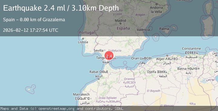
Earthquake STRAIT OF GIBRALTAR
Thu, 12 Feb 2026 17:27:54 GMT
Time1 week ago
Location
36.7904, -5.3467
Depth
3.1 KM
Event Summary
A 2.4 magnitude earthquake struck on STRAIT OF GIBRALTAR, at Thu, 12 Feb 2026 17:27:54 GMT. Depth: 3.1km. Reviewed by IGN seismologists, this minor quake occurred at a magnitude type of ml.
Magnitude
2.4
ml
Source
IGN
Intensity
-
Agency Reports
1 Sources| Source | Magnitude | Depth | Time |
|---|---|---|---|
| IGNPrimary | 2.4 | 3 km | 1 week ago |
Earthquake Details
AutomaticEvent IDemsc_IGN_20260212_0000240
Tsunami PotentialNo
Magnitude Typeml
Nearest Places
- 1.6 km
- 2.5 km
- 3.3 km
- 3.3 km
- 3.5 km
Comments
Join the discussion about this event.
Latest Earthquakes
2.5Mag
South of Java, Indonesia
Time10 hours ago
Depth162.67 km
SourceBMKG
0.6Mag
9 km NW of The Geysers, CA
Time10 hours ago
Depth2.06 km
SourceUSGS (Automatic)
1.2Mag
WESTERN TURKEY
Time10 hours ago
Depth7.60 km
SourceAFAD (Automatic)
3.5Mag
Flores region, Indonesia
Time10 hours ago
Depth638.55 km
SourceVYT (Automatic)
3.2Mag
South of Java, Indonesia
Time10 hours ago
Depth64.99 km
SourceBMKG
Nearby Earthquakes
1.5Mag
STRAIT OF GIBRALTAR
Time4 days ago
Depth11.10 km
SourceIGN (Automatic)
1.7Mag
STRAIT OF GIBRALTAR
Time1 week ago
Depth0.00 km
SourceIGN (Automatic)
1.6Mag
STRAIT OF GIBRALTAR
Time1 week ago
Depth0.00 km
SourceIGN (Automatic)
1.6Mag
STRAIT OF GIBRALTAR
Time6 days ago
Depth7.70 km
SourceIGN (Automatic)
1.7Mag
STRAIT OF GIBRALTAR
Time3 days ago
Depth7.90 km
SourceIGN (Automatic)