Earthquake STRAIT OF GIBRALTAR
Tue, 10 Feb 2026 23:04:12 GMT
Time1 week ago
Location
36.7652, -5.3536
Depth
0.0 KM
Event Summary
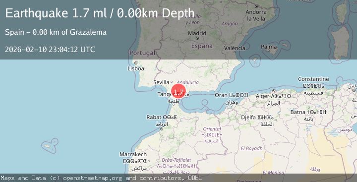
A 1.7 magnitude earthquake struck on STRAIT OF GIBRALTAR, at Tue, 10 Feb 2026 23:04:12 GMT. Depth: 0km. Reviewed by IGN seismologists, this minor quake occurred at a magnitude type of ml.
Magnitude
1.7
ml
Source
IGN
Intensity
-
Agency Reports
1 Sources| Source | Magnitude | Depth | Time |
|---|---|---|---|
| IGNPrimary | 1.7 | 0 km | 1 week ago |
Earthquake Details
AutomaticEvent IDemsc_IGN_20260210_0000354
Tsunami PotentialNo
Magnitude Typeml
Nearest Places
- 1.1 km
- 1.1 km
- 1.3 km
- 1.4 km
- 1.4 km
Comments
Join the discussion about this event.
Latest Earthquakes
2.5Mag
Minahassa Peninsula, Sulawesi
Time4 minutes ago
Depth99.71 km
SourceBMKG
2.2Mag
Tarapaca, Chile
Time4 minutes ago
Depth128.66 km
SourceVYT (Automatic)
3.3Mag
southern Sumatra, Indonesia
Time5 minutes ago
Depth28.69 km
SourceVYT (Automatic)
3.0Mag
South of Sumbawa, Indonesia
Time11 minutes ago
Depth10.00 km
SourceBMKG
1.9Mag
14 km S of Volcano, Hawaii
Time12 minutes ago
Depth4.23 km
SourceUSGS (Automatic)
Nearby Earthquakes
2.4Mag
STRAIT OF GIBRALTAR
Time1 week ago
Depth3.10 km
SourceIGN (Automatic)
1.5Mag
STRAIT OF GIBRALTAR
Time4 days ago
Depth11.10 km
SourceIGN (Automatic)
1.6Mag
STRAIT OF GIBRALTAR
Time1 week ago
Depth0.00 km
SourceIGN (Automatic)
1.6Mag
STRAIT OF GIBRALTAR
Time6 days ago
Depth7.70 km
SourceIGN (Automatic)
1.5Mag
STRAIT OF GIBRALTAR
Time6 days ago
Depth0.20 km
SourceIGN (Automatic)