Earthquake STRAIT OF GIBRALTAR
Tue, 17 Feb 2026 01:58:35 GMT
Time2 days ago
Location
36.6044, -5.3606
Depth
2.1 KM
Event Summary
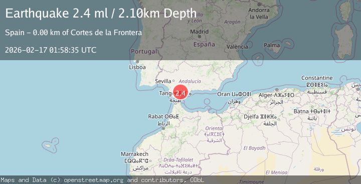
A 2.4 magnitude earthquake struck on STRAIT OF GIBRALTAR, at Tue, 17 Feb 2026 01:58:35 GMT. Depth: 2.1km. Reviewed by IGN seismologists, this minor quake occurred at a magnitude type of ml.
Magnitude
2.4
ml
Source
IGN
Intensity
-
Agency Reports
2 Sources| Source | Magnitude | Depth | Time |
|---|---|---|---|
| IGNPrimary | 2.4 | 2 km | 2 days ago |
| EMSC | 2.4 | 2 km | 2 days ago |
Earthquake Details
AutomaticEvent IDemsc_IGN_20260217_0000040
Tsunami PotentialNo
Magnitude Typeml
Nearest Places
- Aziader1.8 km
- Cortes de la Frontera2.1 km
- Sol y Sierra2.5 km
- Sierra de los Pinos3.4 km
- Garganta de la Pulga4.1 km
Comments
Join the discussion about this event.
Latest Earthquakes
3.1Mag
Bali Region, Indonesia
Time58 minutes ago
Depth19.14 km
SourceBMKG
2.7Mag
Coquimbo, Chile
Time59 minutes ago
Depth14.16 km
SourceVYT (Automatic)
1.7Mag
Southeastern Alaska
Time1 hour ago
Depth5.98 km
SourceVYT (Automatic)
2.1Mag
Tarapaca, Chile
Time1 hour ago
Depth110.35 km
SourceVYT (Automatic)
2.7Mag
Minahassa Peninsula, Sulawesi
Time1 hour ago
Depth114.15 km
SourceBMKG
Nearby Earthquakes
2.3Mag
STRAIT OF GIBRALTAR
Time3 days ago
Depth0.00 km
SourceIGN (Automatic)
1.5Mag
STRAIT OF GIBRALTAR
Time3 hours ago
Depth0.00 km
SourceIGN (Automatic)
2.5Mag
STRAIT OF GIBRALTAR
Time4 days ago
Depth0.00 km
SourceIGN (Automatic)
2.2Mag
STRAIT OF GIBRALTAR
Time5 days ago
Depth0.00 km
SourceIGN (Automatic)
1.6Mag
STRAIT OF GIBRALTAR
Time1 week ago
Depth0.00 km
SourceIGN (Automatic)