Earthquake NEAR COAST OF SOUTHERN PERU
Mon, 22 Feb 2021 12:41:48 GMT
Time4 years ago
Location
-17.0800, -71.6600
Depth
53.0 KM
Event Summary
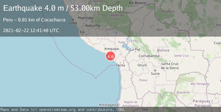
A 4.0 magnitude earthquake struck on NEAR COAST OF SOUTHERN PERU, at Mon, 22 Feb 2021 12:41:48 GMT. Depth: 53km. Reviewed by LIM seismologists, this light quake occurred at a magnitude type of m.
Magnitude
4.0
m
Source
LIM
Intensity
-
Agency Reports
1 Sources| Source | Magnitude | Depth | Time |
|---|---|---|---|
| LIMPrimary | 4.0 | 53 km | 4 years ago |
Earthquake Details
AutomaticEvent IDemsc_LIM_20210222_0000073
Tsunami PotentialNo
Magnitude Typem
Nearest Places
- Señal Chucarapi1.6 km
- Loma Chucarapi2.3 km
- Cerro Ventillata4.5 km
- Cerro Ayanquera4.5 km
- Cerro Laguna4.6 km
Comments
Join the discussion about this event.
Latest Earthquakes
1.7Mag
western Texas
Time5 minutes ago
Depth3.42 km
SourceVYT (Automatic)
3.8Mag
Seram, Indonesia
Time7 minutes ago
Depth0.00 km
SourceVYT (Automatic)
1.6Mag
54 km WNW of Toyah, Texas
Time13 minutes ago
Depth0.00 km
SourceUSGS (Automatic)
2.2Mag
West Papua Region, Indonesia
Time14 minutes ago
Depth26.69 km
SourceBMKG
1.2Mag
WESTERN TURKEY
Time15 minutes ago
Depth7.00 km
SourceAFAD (Automatic)
Nearby Earthquakes
4.2Mag
NEAR COAST OF SOUTHERN PERU
Time1 month ago
Depth74.00 km
SourceLIM (Automatic)
5.0Mag
NEAR COAST OF SOUTHERN PERU
Time10 years ago
Depth58.00 km
SourceEMSC (Automatic)
3.7Mag
NEAR COAST OF SOUTHERN PERU
Time2 days ago
Depth76.00 km
SourceLIM (Automatic)
4.0Mag
NEAR COAST OF SOUTHERN PERU
Time2 years ago
Depth105.30 km
SourceNEIC (Automatic)
4.4Mag
NEAR COAST OF SOUTHERN PERU
Time1 month ago
Depth46.00 km
SourceEMSC (Automatic)