Earthquake PERU-ECUADOR BORDER REGION
Wed, 21 Jan 2026 10:35:09 GMT
Time6 days ago
Location
-4.0700, -80.7600
Depth
27.0 KM
Event Summary
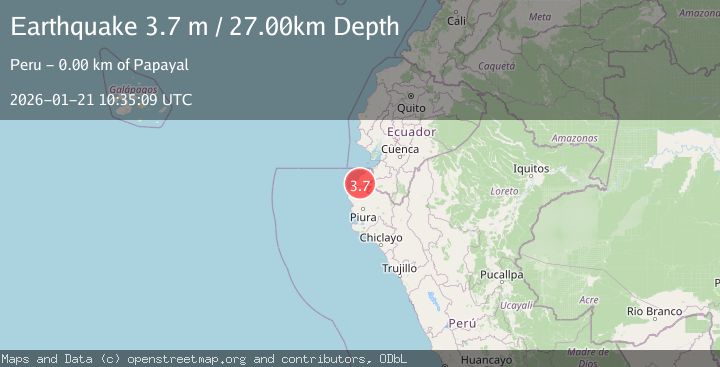
A 3.7 magnitude earthquake struck on PERU-ECUADOR BORDER REGION, at Wed, 21 Jan 2026 10:35:09 GMT. Depth: 27km. Reviewed by LIM seismologists, this minor quake occurred at a magnitude type of m.
Magnitude
3.7
m
Source
LIM
Intensity
-
Agency Reports
1 Sources| Source | Magnitude | Depth | Time |
|---|---|---|---|
| LIMPrimary | 3.7 | 27 km | 6 days ago |
Earthquake Details
AutomaticEvent IDemsc_LIM_20260121_0000177
Tsunami PotentialNo
Magnitude Typem
Nearest Places
- Rocoche0.8 km
- Pavas1.0 km
- Rocoche1.7 km
- Quebrada del Pilar1.9 km
- Quebrada Tazajeros1.9 km
Comments
Join the discussion about this event.
Latest Earthquakes
0.9Mag
10 km SSW of Valle Vista, CA
Time14 minutes ago
Depth15.42 km
SourceUSGS (Automatic)
2.8Mag
Java, Indonesia
Time22 minutes ago
Depth109.39 km
SourceBMKG (Automatic)
1.5Mag
26 km E of Bridgeport, California
Time22 minutes ago
Depth11.74 km
SourceUSGS (Automatic)
2.2Mag
Sumbawa Region, Indonesia
Time31 minutes ago
Depth51.34 km
SourceBMKG (Automatic)
3.0Mag
OREGON
Time37 minutes ago
Depth0.20 km
SourceUW (Automatic)