Earthquake Sumbawa Region, Indonesia
Tue, 27 Jan 2026 21:31:31 GMT
Time1 hour ago
Location
-9.3584, 118.7127
Depth
51.3 KM
Event Summary
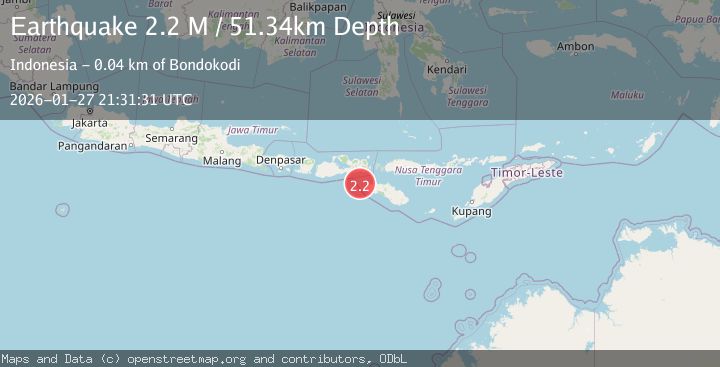
A 2.2 magnitude earthquake struck on Sumbawa Region, Indonesia, at Tue, 27 Jan 2026 21:31:31 GMT. Depth: 51.340294km. Reviewed by BMKG seismologists, this minor quake occurred at a magnitude type of M.
Magnitude
2.2
M
Source
BMKG
Intensity
-
Agency Reports
1 Sources| Source | Magnitude | Depth | Time |
|---|---|---|---|
| BMKGPrimary | 2.2 | 51 km | 1 hour ago |
Earthquake Details
AutomaticEvent IDbmg2026bxdr
Tsunami PotentialNo
Magnitude TypeM
Nearest Places
- Tanjung Karosso25.1 km
- Tanjung Wailakareh30.4 km
- Waitungga31.2 km
- Waikahaka31.4 km
- Kendonga Wailakareh31.4 km
Comments
Join the discussion about this event.
Latest Earthquakes
3.0Mag
OREGON
Time2 hours ago
Depth0.20 km
SourceUW (Automatic)
3.0Mag
12 km SE of Port Orford, Oregon
Time2 hours ago
Depth0.23 km
SourceUSGS
3.3Mag
Northern Sumatra, Indonesia
Time2 hours ago
Depth10.00 km
SourceBMKG (Automatic)
1.2Mag
21 km SE of Livengood, Alaska
Time2 hours ago
Depth8.60 km
SourceUSGS (Automatic)
4.2Mag
West Papua Region, Indonesia
Time2 hours ago
Depth44.55 km
SourceBMKG (Automatic)
Nearby Earthquakes
2.9Mag
Sumbawa Region, Indonesia
Time13 hours ago
Depth86.58 km
SourceBMKG (Automatic)
2.1Mag
Sumbawa Region, Indonesia
Time2 days ago
Depth66.59 km
SourceBMKG (Automatic)
2.9Mag
Sumbawa Region, Indonesia
Time2 days ago
Depth10.00 km
SourceBMKG (Automatic)
3.3Mag
Sumbawa Region, Indonesia
Time5 days ago
Depth10.00 km
SourceBMKG (Automatic)
3.1Mag
Sumbawa Region, Indonesia
Time3 days ago
Depth10.00 km
SourceBMKG (Automatic)