Earthquake MYANMAR-INDIA BORDER REGION
Sun, 31 May 2020 00:54:36 GMT
Time5 years ago
Location
25.1000, 94.9000
Depth
82.0 KM
Event Summary
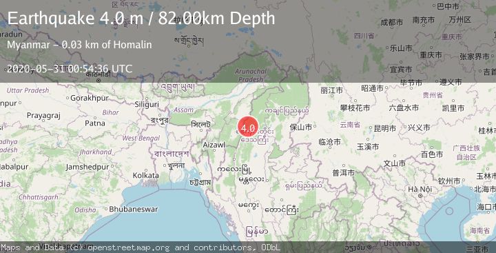
A 4.0 magnitude earthquake struck on MYANMAR-INDIA BORDER REGION, at Sun, 31 May 2020 00:54:36 GMT. Depth: 82km. Reviewed by NDI seismologists, this light quake occurred at a magnitude type of m.
Magnitude
4.0
m
Source
NDI
Intensity
-
Agency Reports
1 Sources| Source | Magnitude | Depth | Time |
|---|---|---|---|
| NDIPrimary | 4.0 | 82 km | 5 years ago |
Earthquake Details
AutomaticEvent IDemsc_NDI_20200531_0000004
Tsunami PotentialNo
Magnitude Typem
Nearest Places
- 0.0 km
- 5.8 km
- 7.7 km
- 9.9 km
- 9.9 km
Comments
Join the discussion about this event.
Latest Earthquakes
5.0Mag
Halmahera, Indonesia
Time18 hours ago
Depth105.96 km
SourceVYT (Automatic)
2.4Mag
Potosi, Bolivia
Time18 hours ago
Depth182.25 km
SourceVYT (Automatic)
3.6Mag
Java, Indonesia
Time18 hours ago
Depth0.00 km
SourceVYT (Automatic)
2.0Mag
22 km ENE of San Ardo, CA
Time18 hours ago
Depth1.42 km
SourceUSGS (Automatic)
0.8Mag
8 km NW of The Geysers, CA
Time18 hours ago
Depth1.52 km
SourceUSGS (Automatic)
Nearby Earthquakes
4.0Mag
MYANMAR-INDIA BORDER REGION
Time2 years ago
Depth116.00 km
SourceEMSC (Automatic)
5.2Mag
MYANMAR-INDIA BORDER REGION
Time8 years ago
Depth80.00 km
SourceEMSC (Automatic)
4.2Mag
MYANMAR-INDIA BORDER REGION
Time3 weeks ago
Depth105.50 km
SourceNDI (Automatic)
5.1Mag
MYANMAR-INDIA BORDER REGION
Time4 years ago
Depth100.00 km
SourceEMSC (Automatic)
3.0Mag
MYANMAR
Time2 years ago
Depth125.00 km
SourceNDI (Automatic)