Earthquake NEPAL-INDIA BORDER REGION
Fri, 06 Feb 2026 02:02:01 GMT
Time3 hours ago
Location
27.3600, 82.0500
Depth
10.0 KM
Event Summary
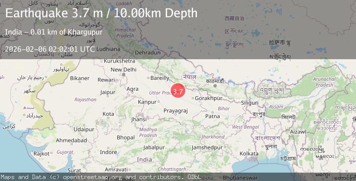
A 3.7 magnitude earthquake struck on NEPAL-INDIA BORDER REGION, at Fri, 06 Feb 2026 02:02:01 GMT. Depth: 10km. Reviewed by NDI seismologists, this minor quake occurred at a magnitude type of m.
Magnitude
3.7
m
Source
NDI
Intensity
-
Agency Reports
1 Sources| Source | Magnitude | Depth | Time |
|---|---|---|---|
| NDIPrimary | 3.7 | 10 km | 3 hours ago |
Earthquake Details
AutomaticEvent IDemsc_NDI_20260206_0000036
Tsunami PotentialNo
Magnitude Typem
Nearest Places
- Pura Dujai0.2 km
- Nawāpurwa0.5 km
- Purwa Rām Dayāl0.5 km
- Pura Mohan0.6 km
- Pura Ganga0.6 km
Comments
Join the discussion about this event.
Latest Earthquakes
1.6Mag
98 km NW of Yakutat, Alaska
Time3 minutes ago
Depth23.10 km
SourceUSGS (Automatic)
3.5Mag
Southern Sumatra, Indonesia
Time9 minutes ago
Depth67.02 km
SourceBMKG (Automatic)
2.8Mag
Bali Region, Indonesia
Time11 minutes ago
Depth94.28 km
SourceBMKG (Automatic)
2.4Mag
FRANCE
Time23 minutes ago
Depth5.00 km
SourceReNaSS (Automatic)
3.3Mag
SOUTH OF KERMADEC ISLANDS
Time24 minutes ago
Depth100.00 km
SourceGNS (Automatic)
Nearby Earthquakes
2.5Mag
NEPAL
Time3 days ago
Depth10.00 km
SourceNDI (Automatic)
2.9Mag
UTTAR PRADESH, INDIA
Time2 weeks ago
Depth97.30 km
SourceNDI (Automatic)
3.4Mag
WESTERN XIZANG-INDIA BORDER REG.
Time2 hours ago
Depth10.00 km
SourceNDI (Automatic)
3.6Mag
WESTERN XIZANG
Time4 days ago
Depth145.40 km
SourceNDI (Automatic)
3.0Mag
WESTERN XIZANG
Time1 week ago
Depth10.00 km
SourceNDI (Automatic)