Earthquake INDIA-BANGLADESH BORDER REGION
Sat, 28 Feb 2026 00:15:26 GMT
Time2 days ago
Location
24.9300, 92.7300
Depth
10.0 KM
Event Summary
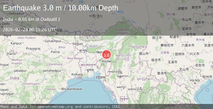
A 3.0 magnitude earthquake struck on INDIA-BANGLADESH BORDER REGION, at Sat, 28 Feb 2026 00:15:26 GMT. Depth: 10km. Reviewed by NDI seismologists, this minor quake occurred at a magnitude type of m.
Magnitude
3.0
m
Source
NDI
Intensity
-
Agency Reports
1 Sources| Source | Magnitude | Depth | Time |
|---|---|---|---|
| NDIPrimary | 3.0 | 10 km | 2 days ago |
Earthquake Details
AutomaticEvent IDemsc_NDI_20260228_0000002
Tsunami PotentialNo
Magnitude Typem
Nearest Places
- 1.4 km
- 1Dalu5.4 km
- 5.5 km
- 6.3 km
- 6.5 km
Comments
Join the discussion about this event.
Latest Earthquakes
2.1Mag
near the coast of Tarapaca, Chile
Time15 hours ago
Depth28.69 km
SourceVYT (Automatic)
2.3Mag
northern Sumatra, Indonesia
Time16 hours ago
Depth0.00 km
SourceVYT (Automatic)
2.3Mag
Sumbawa Region, Indonesia
Time16 hours ago
Depth20.94 km
SourceBMKG
2.2Mag
Kenai Peninsula, Alaska
Time16 hours ago
Depth53.96 km
SourceVYT (Automatic)
2.9Mag
Java, Indonesia
Time16 hours ago
Depth10.00 km
SourceBMKG
Nearby Earthquakes
4.0Mag
INDIA-BANGLADESH BORDER REGION
Time5 years ago
Depth63.00 km
SourceNDI (Automatic)
5.0Mag
INDIA-BANGLADESH BORDER REGION
Time19 years ago
Depth40.00 km
SourceEMSC (Automatic)
3.0Mag
MEGHALAYA - ASSAM REGION, INDIA
Time10 years ago
Depth10.00 km
SourceNDI (Automatic)
5.5Mag
INDIA-BANGLADESH BORDER REGION
Time21 years ago
Depth60.00 km
SourceEMSC (Automatic)
5.1Mag
MANIPUR, INDIA REGION
Time3 years ago
Depth10.00 km
SourceEMSC (Automatic)