Earthquake SOUTHWEST OF SUMATRA, INDONESIA
Tue, 18 Aug 2020 22:39:08 GMT
Time5 years ago
Location
-4.4600, 100.9600
Depth
15.0 KM
Event Summary
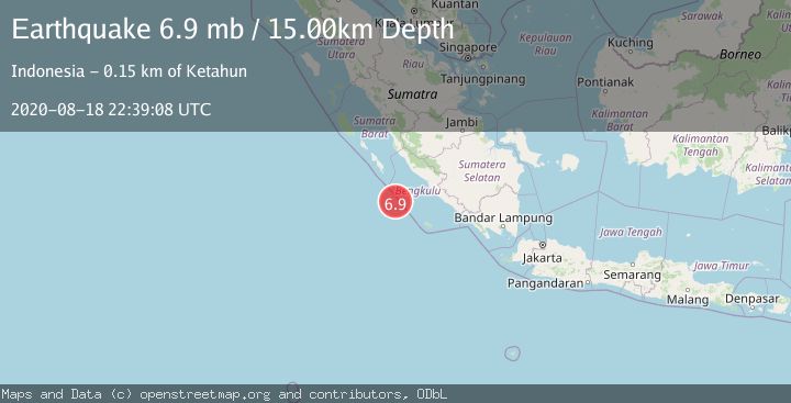
A 6.9 magnitude earthquake struck on SOUTHWEST OF SUMATRA, INDONESIA, at Tue, 18 Aug 2020 22:39:08 GMT. Depth: 15km. Reviewed by NEIC seismologists, this strong quake occurred at a magnitude type of mb.
Magnitude
6.9
mb
Source
NEIC
Intensity
-
Agency Reports
2 Sources| Source | Magnitude | Depth | Time |
|---|---|---|---|
| NEICPrimary | 5.0 | 15 km | 5 years ago |
| EMSC | 6.9 | 39 km | 5 years ago |
Earthquake Details
AutomaticEvent IDemsc_NEIC_20200818_0000286
Tsunami PotentialNo
Magnitude Typemb
Nearest Places
- Pulau Mega51.8 km
- Mentawai Trough78.8 km
- Pulau Sanding114.8 km
- Europa Reefs116.0 km
- Pulau Situpai116.8 km
Comments
Join the discussion about this event.
Latest Earthquakes
2.3Mag
Poland
Time17 hours ago
Depth0.00 km
SourceVYT (Automatic)
0.8Mag
Southern Alaska
Time17 hours ago
Depth3.54 km
SourceVYT (Automatic)
2.5Mag
Sumba Region, Indonesia
Time17 hours ago
Depth68.38 km
SourceBMKG
1.4Mag
Southern Alaska
Time17 hours ago
Depth78.86 km
SourceVYT (Automatic)
2.7Mag
Minahassa Peninsula, Sulawesi
Time17 hours ago
Depth135.89 km
SourceBMKG
Nearby Earthquakes
5.1Mag
SOUTHERN SUMATRA, INDONESIA
Time14 years ago
Depth15.00 km
SourceEMSC (Automatic)
5.3Mag
SOUTHERN SUMATRA, INDONESIA
Time17 years ago
Depth28.00 km
SourceEMSC (Automatic)
6.8Mag
SOUTHWEST OF SUMATRA, INDONESIA
Time18 years ago
Depth10.00 km
SourceGFZ (Automatic)
5.9Mag
SOUTHWEST OF SUMATRA, INDONESIA
Time17 years ago
Depth60.00 km
SourceEMSC (Automatic)
5.0Mag
SOUTHERN SUMATRA, INDONESIA
Time17 years ago
Depth37.00 km
SourceEMSC (Automatic)