Earthquake MYANMAR-INDIA BORDER REGION
Tue, 20 Oct 2020 19:55:49 GMT
Time5 years ago
Location
27.2200, 96.1500
Depth
57.0 KM
Event Summary
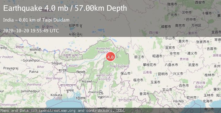
A 4.0 magnitude earthquake struck on MYANMAR-INDIA BORDER REGION, at Tue, 20 Oct 2020 19:55:49 GMT. Depth: 57km. Reviewed by NEIC seismologists, this light quake occurred at a magnitude type of mb.
Magnitude
4.0
mb
Source
NEIC
Intensity
-
Agency Reports
1 Sources| Source | Magnitude | Depth | Time |
|---|---|---|---|
| NEICPrimary | 4.0 | 57 km | 5 years ago |
Earthquake Details
AutomaticEvent IDemsc_NEIC_20201020_0000218
Tsunami PotentialNo
Magnitude Typemb
Nearest Places
- 0.6 km
- 2.9 km
- 3.7 km
- 4.0 km
- 5.2 km
Comments
Join the discussion about this event.
Latest Earthquakes
1.6Mag
11 km NE of San Simeon, CA
Time11 minutes ago
Depth9.12 km
SourceUSGS (Automatic)
3.0Mag
OFFSHORE LOS LAGOS, CHILE
Time11 minutes ago
Depth29.00 km
SourceCSN (Automatic)
2.0Mag
Poland
Time19 minutes ago
Depth5.62 km
SourceVYT (Automatic)
1.4Mag
3 km WSW of Mira Loma, CA
Time19 minutes ago
Depth7.18 km
SourceUSGS (Automatic)
2.2Mag
WESTERN TURKEY
Time21 minutes ago
Depth24.40 km
SourceAFAD (Automatic)
Nearby Earthquakes
4.0Mag
ARUNACHAL PRADESH-ASSAM, INDIA
Time7 years ago
Depth10.00 km
SourceNDI (Automatic)
3.5Mag
MYANMAR-INDIA BORDER REGION
Time5 days ago
Depth10.00 km
SourceNDI (Automatic)
5.2Mag
MYANMAR-INDIA BORDER REGION
Time7 years ago
Depth40.00 km
SourceEMSC (Automatic)
3.0Mag
MYANMAR
Time1 year ago
Depth19.00 km
SourceNDI (Automatic)
2.8Mag
MYANMAR
Time6 days ago
Depth80.00 km
SourceNDI (Automatic)