Earthquake SAMOA ISLANDS REGION
Tue, 15 Dec 2020 05:06:31 GMT
Time5 years ago
Location
-15.7100, -172.7400
Depth
10.0 KM
Event Summary
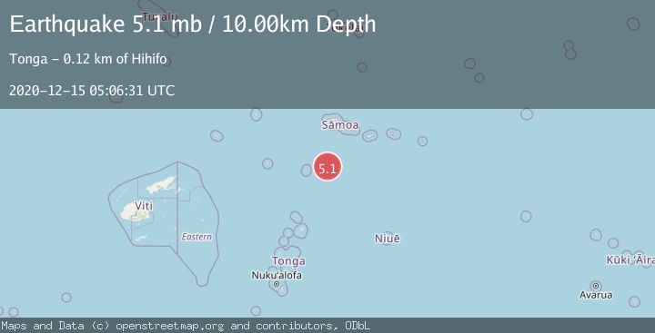
A 5.1 magnitude earthquake struck on SAMOA ISLANDS REGION, at Tue, 15 Dec 2020 05:06:31 GMT. Depth: 10km. Reviewed by NEIC seismologists, this moderate quake occurred at a magnitude type of mb.
Magnitude
5.1
mb
Source
NEIC
Intensity
-
Agency Reports
1 Sources| Source | Magnitude | Depth | Time |
|---|---|---|---|
| NEICPrimary | 5.1 | 10 km | 5 years ago |
Earthquake Details
AutomaticEvent IDemsc_NEIC_20201215_0000046
Tsunami PotentialNo
Magnitude Typemb
Nearest Places
- 98.0 km
- 108.2 km
- 108.9 km
- 110.0 km
- 110.2 km
Comments
Join the discussion about this event.
Latest Earthquakes
2.6Mag
West Papua Region, Indonesia
Time6 minutes ago
Depth21.77 km
SourceBMKG
2.5Mag
Java, Indonesia
Time7 minutes ago
Depth93.36 km
SourceBMKG
2.2Mag
SAN FRANCISCO BAY AREA, CALIF.
Time9 minutes ago
Depth8.50 km
SourceNC (Automatic)
1.6Mag
16 km NW of Parkfield, CA
Time13 minutes ago
Depth3.41 km
SourceUSGS (Automatic)
3.0Mag
West Papua Region, Indonesia
Time16 minutes ago
Depth27.52 km
SourceBMKG
Nearby Earthquakes
5.4Mag
SAMOA ISLANDS REGION
Time6 years ago
Depth48.00 km
SourceEMSC (Automatic)
5.0Mag
SAMOA ISLANDS REGION
Time16 years ago
Depth2.00 km
SourceEMSC (Automatic)
5.9Mag
SAMOA ISLANDS REGION
Time6 years ago
Depth10.00 km
SourceEMSC (Automatic)
5.7Mag
SAMOA ISLANDS REGION
Time10 years ago
Depth2.00 km
SourceEMSC (Automatic)
5.1Mag
SAMOA ISLANDS REGION
Time16 years ago
Depth35.00 km
SourceNEIC (Automatic)